MyTopo
Wickiup Creek Montana US Topo Map
Couldn't load pickup availability
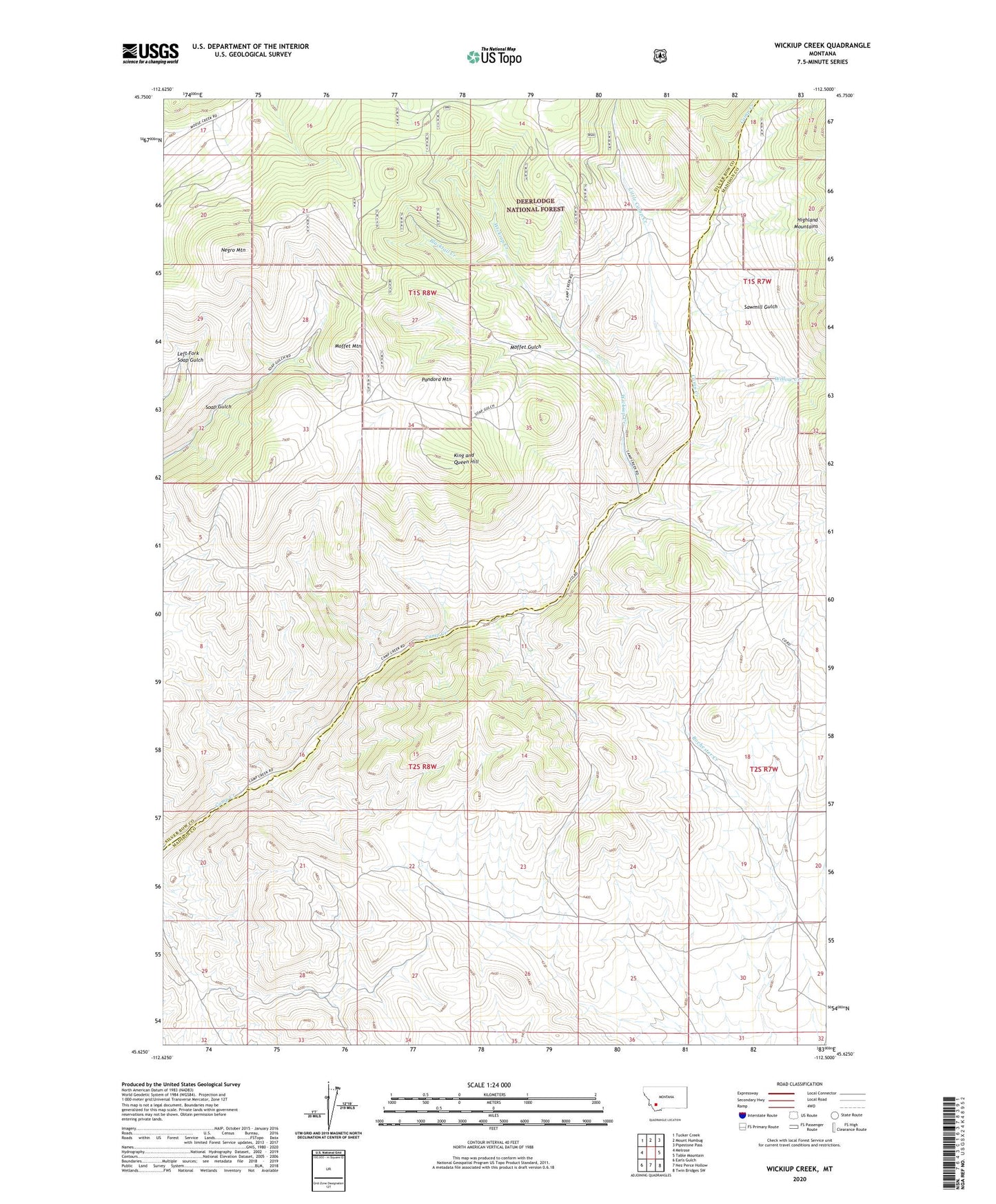
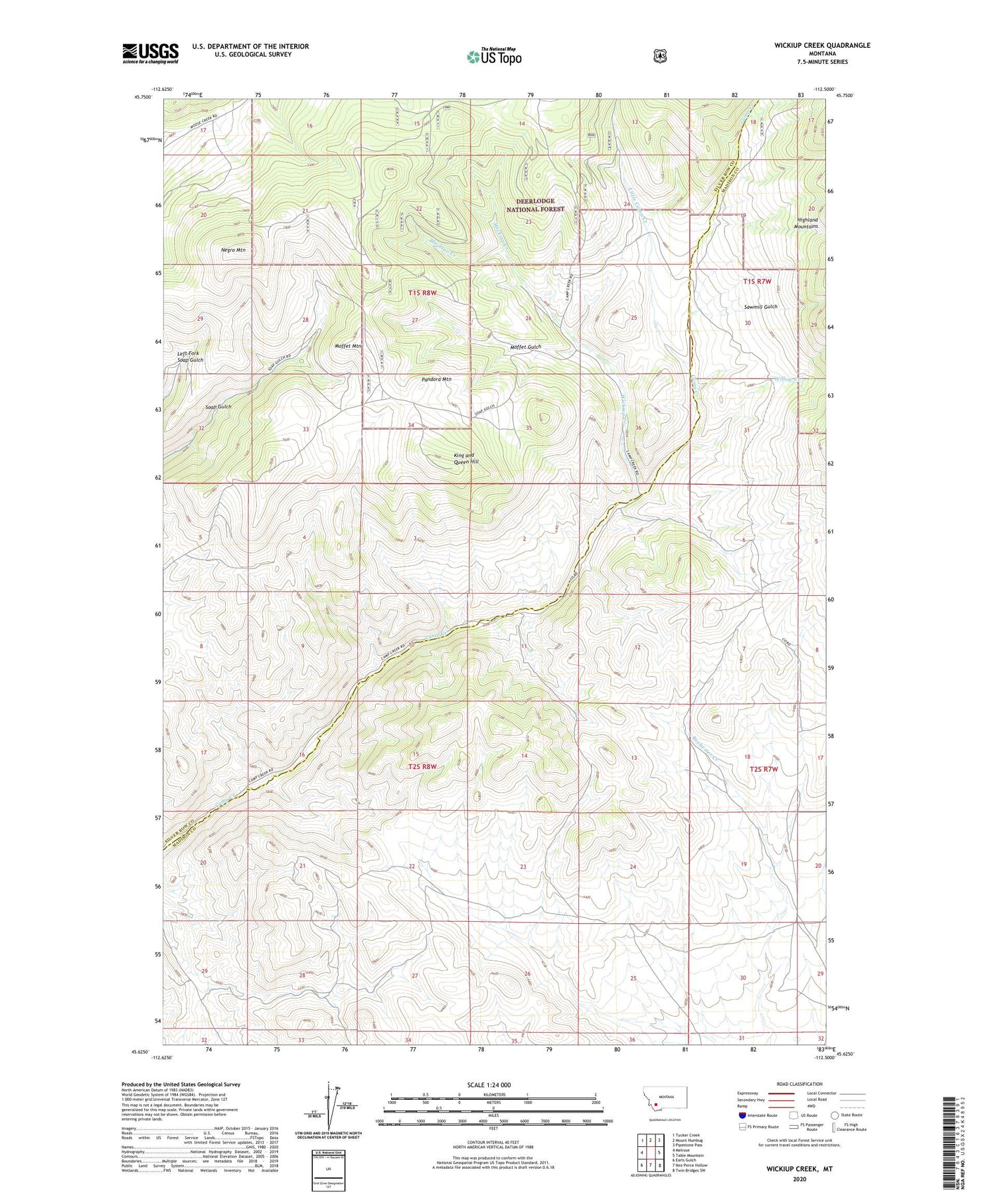
2020 topographic map quadrangle Wickiup Creek in the state of Montana. Scale: 1:24000. Based on the newly updated USGS 7.5' US Topo map series, this map is in the following counties: Silver Bow, Madison. The map contains contour data, water features, and other items you are used to seeing on USGS maps, but also has updated roads and other features. This is the next generation of topographic maps. Printed on high-quality waterproof paper with UV fade-resistant inks.
Quads adjacent to this one:
West: Melrose
Northwest: Tucker Creek
North: Mount Humbug
Northeast: Pipestone Pass
East: Table Mountain
Southeast: Twin Bridges SW
South: Nez Perce Hollow
Southwest: Earls Gulch
Contains the following named places: Blacktail Creek, Clipper Mine, Columbia Mine, Cow Camp, King and Queen Hill, Little Camp Creek, Lizzie Ann Mine, Locust-Assey Mine, Moffet Gulch, Moffet Mountain, NE NE Section 20 Mine, NE NE Section 28 Mine, NE NE Section 8 Mine, NE NW Section 11 Mine, NE NW Section 20 Mine, NE SE Section 29 Mine, NE SW Section 21 Mine, NE SW Section 4 Mine, Negro Mountain, Norwood Post Office, NW SE Section 28 Mine, NW SW Section 28 Mine, Pandora Mountain, Pandora/Pilon Mine, Penobscot Mine, Sawmill Gulch, SE SE Section 17 Mine, SE SW Section 12 Mine, SE SW Section 2 Mine, SE SW Section 29 Mine, SE SW Section 3 Mine, Smith Dam, Spring Mine, Summit/Mount Hecla Mine, SW NE Section 11 Mine, SW NE Section 28 Mine, SW NE Section 32 Mine, SW SE Section 17 Mine, SW SE Section 21 Mine, Wickiup Creek, Willow Creek, Yellow Metal Mine