MyTopo
Twin Bridges SW Montana US Topo Map
Couldn't load pickup availability
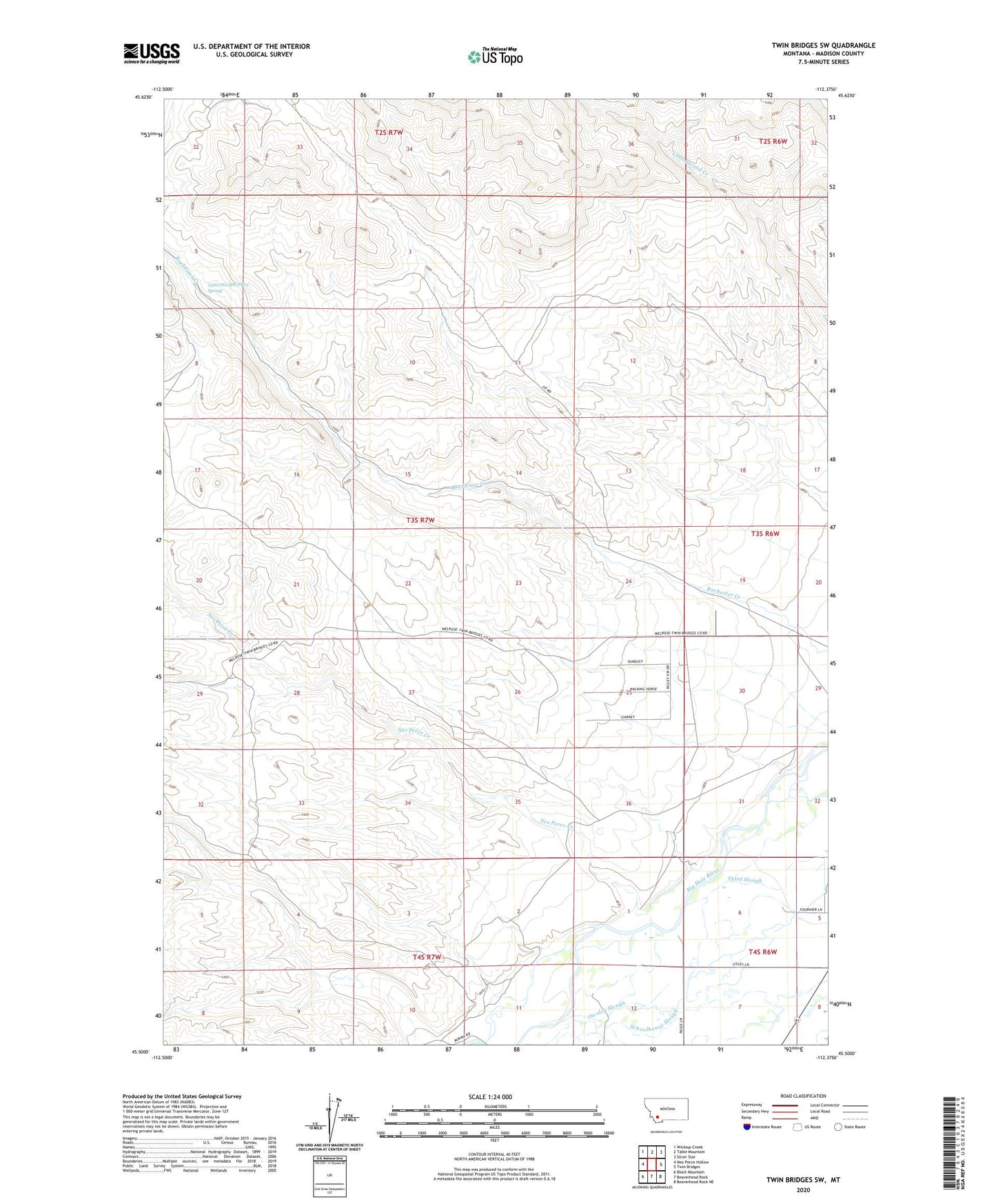
2024 topographic map quadrangle Twin Bridges SW in the state of Montana. Scale: 1:24000. Based on the newly updated USGS 7.5' US Topo map series, this map is in the following counties: Madison. The map contains contour data, water features, and other items you are used to seeing on USGS maps, but also has updated roads and other features. This is the next generation of topographic maps. Printed on high-quality waterproof paper with UV fade-resistant inks.
Quads adjacent to this one:
West: Nez Perce Hollow
Northwest: Wickiup Creek
North: Table Mountain
Northeast: Silver Star
East: Twin Bridges
Southeast: Beaverhead Rock NE
South: Beaverhead Rock
Southwest: Block Mountain
This map covers the same area as the classic USGS quad with code o45112e4.
Contains the following named places: 03S07W05DCDB01 Spring, Alaska Mine, Anything Mine, Crystal Mine, Eclipse Mine, Elizabeth Mine, Ellen Marshall Mine, End Mine, Full House Mine, Hermit Mine, Idler Mine, Monitor Mine, Muriers, NE Section 4 Mine, Never Fail Mine, Nez Perce Creek, NW Section 15 Mine, NW Section 26 Mine, NW Section 33 Mine, NW Section 5 Mine, Pageville Post Office, Pageville School, Pennington Bridge Fishing Access Site, Rock Spring Ranch, Sunbeam/ID Number 2 Mine, SW Section 3 Mine, SW Section 9 Mine