MyTopo
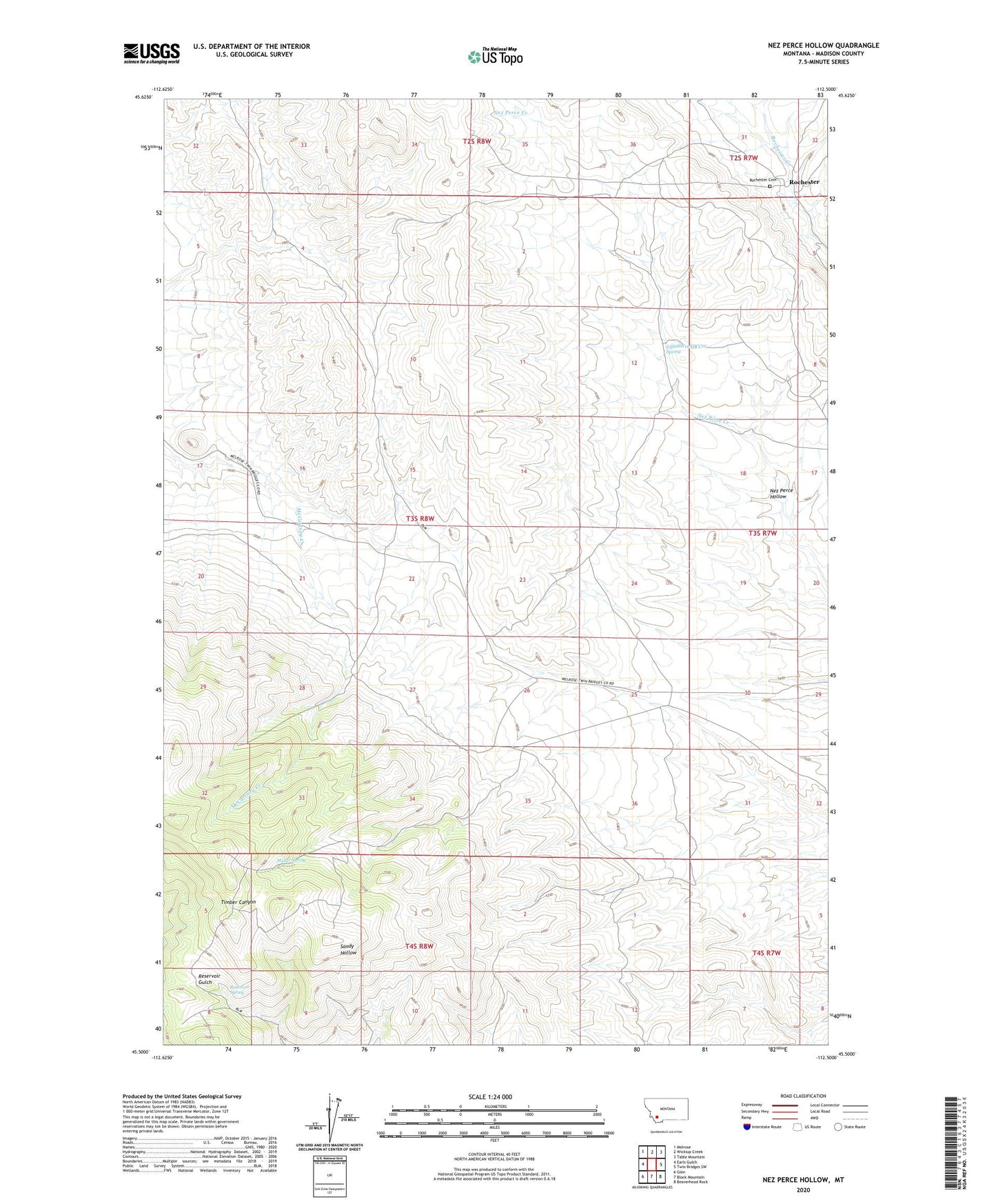
Nez Perce Hollow Montana US Topo Map
Couldn't load pickup availability
2024 topographic map quadrangle Nez Perce Hollow in the state of Montana. Scale: 1:24000. Based on the newly updated USGS 7.5' US Topo map series, this map is in the following counties: Madison. The map contains contour data, water features, and other items you are used to seeing on USGS maps, but also has updated roads and other features. This is the next generation of topographic maps. Printed on high-quality waterproof paper with UV fade-resistant inks.
Quads adjacent to this one:
West: Earls Gulch
Northwest: Melrose
North: Wickiup Creek
Northeast: Table Mountain
East: Twin Bridges SW
Southeast: Beaverhead Rock
South: Block Mountain
Southwest: Glen
This map covers the same area as the classic USGS quad with code o45112e5.
Contains the following named places: 03S08W01BBAD01 Well, 03S08W12ADCC01 Spring, 03S08W14AACB01 Well, Ajax Mine, Beacon Light Mine, Champion Mine, Cooper Mine, Emma Mine, Golden Fleece Mine, Index Mine, Longfellow Mine, Mountain View Mine, Mueller/Bessie Mine, Muller Spring, New Mine, Nez Perce Hollow, Reservoir Spring, Rochester, Rochester Cemetery, Rochester Post Office, Rochester School, Shoemaker Mine, Shortfellow Mine, Watazicka Mine, Watseca Mine