MyTopo
Wild Bill Flat East Montana US Topo Map
Couldn't load pickup availability
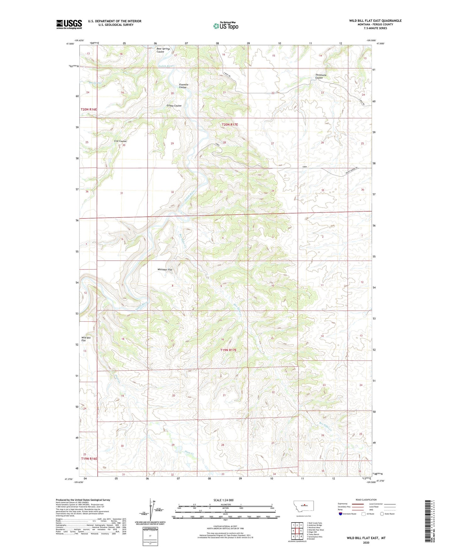
2024 topographic map quadrangle Wild Bill Flat East in the state of Montana. Scale: 1:24000. Based on the newly updated USGS 7.5' US Topo map series, this map is in the following counties: Fergus. The map contains contour data, water features, and other items you are used to seeing on USGS maps, but also has updated roads and other features. This is the next generation of topographic maps. Printed on high-quality waterproof paper with UV fade-resistant inks.
Quads adjacent to this one:
West: Wild Bill Flat West
Northwest: Wolf Creek Falls
North: Anderson Bridge
Northeast: Winifred West
East: Hilger NW
Southeast: Kendall
South: Seventytwo Hills
Southwest: Toney Bench
This map covers the same area as the classic USGS quad with code o47109d5.
Contains the following named places: Balky Horse School, Bear Springs, Bear Springs Coulee, Box Elder Creek, Cral Coulee, Fivemile Coulee, Gilkey Coulee, Plum Creek, Threemile Coulee, Whitaker Flat, Wild Bill Flat