MyTopo
Wild Bill Flat West Montana US Topo Map
Couldn't load pickup availability
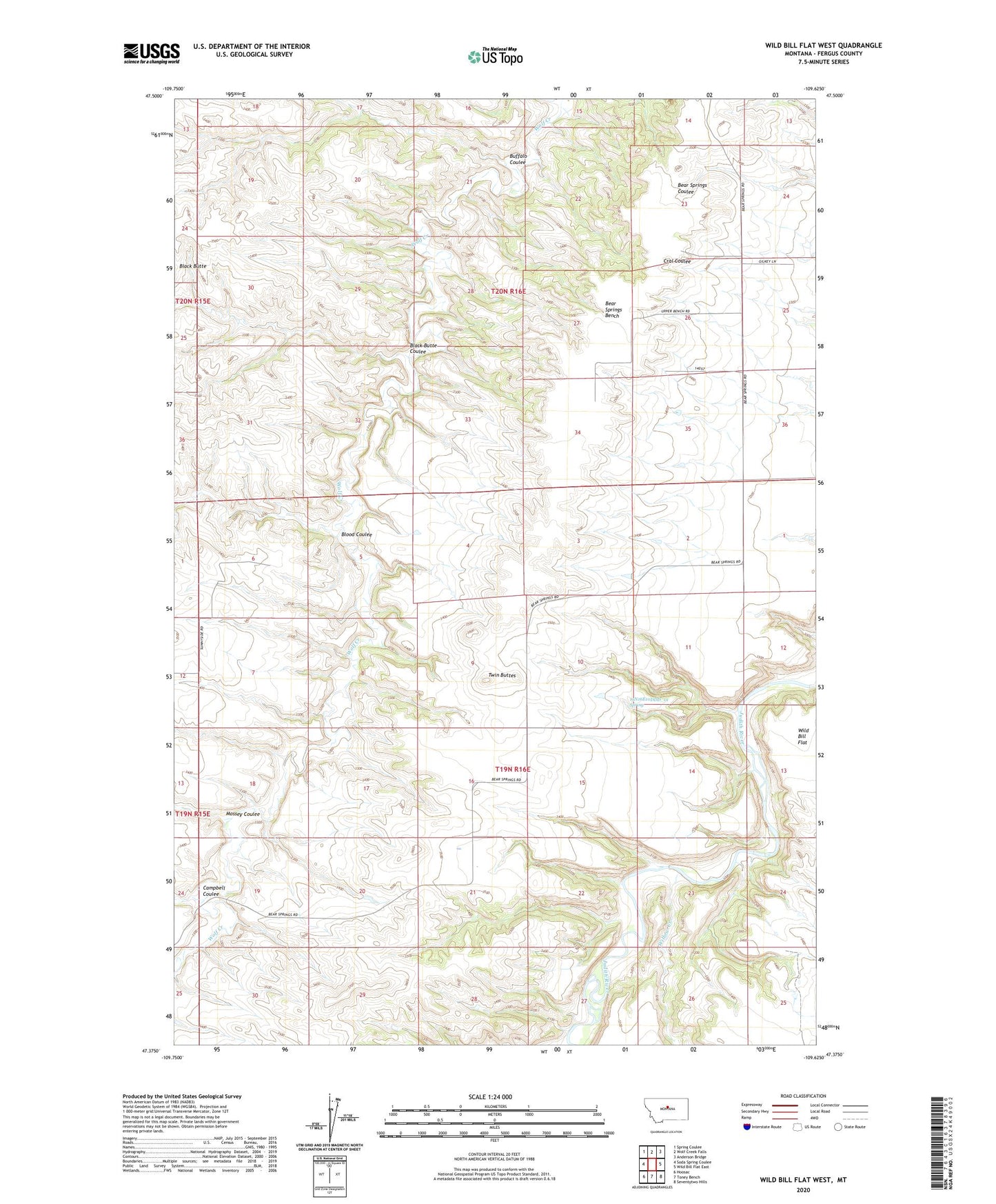
2024 topographic map quadrangle Wild Bill Flat West in the state of Montana. Scale: 1:24000. Based on the newly updated USGS 7.5' US Topo map series, this map is in the following counties: Fergus. The map contains contour data, water features, and other items you are used to seeing on USGS maps, but also has updated roads and other features. This is the next generation of topographic maps. Printed on high-quality waterproof paper with UV fade-resistant inks.
Quads adjacent to this one:
West: Soda Spring Coulee
Northwest: Spring Coulee
North: Wolf Creek Falls
Northeast: Anderson Bridge
East: Wild Bill Flat East
Southeast: Seventytwo Hills
South: Toney Bench
Southwest: Hoosac
This map covers the same area as the classic USGS quad with code o47109d6.
Contains the following named places: 19N16E04CCC_01 Well, 19N16E10DDD_01 Spring, 19N16E11AAA_01 Well, 19N16E11BBB_01 Well, Bear Spring Post Office, Bear Spring School, Black Butte, Black Butte Coulee, Blood Coulee, Buffalo Coulee, Campbell Coulee, Mossey Coulee, Twin Buttes, Twin Buttes School, Willow Creek