MyTopo
Windy Hill Montana US Topo Map
Couldn't load pickup availability
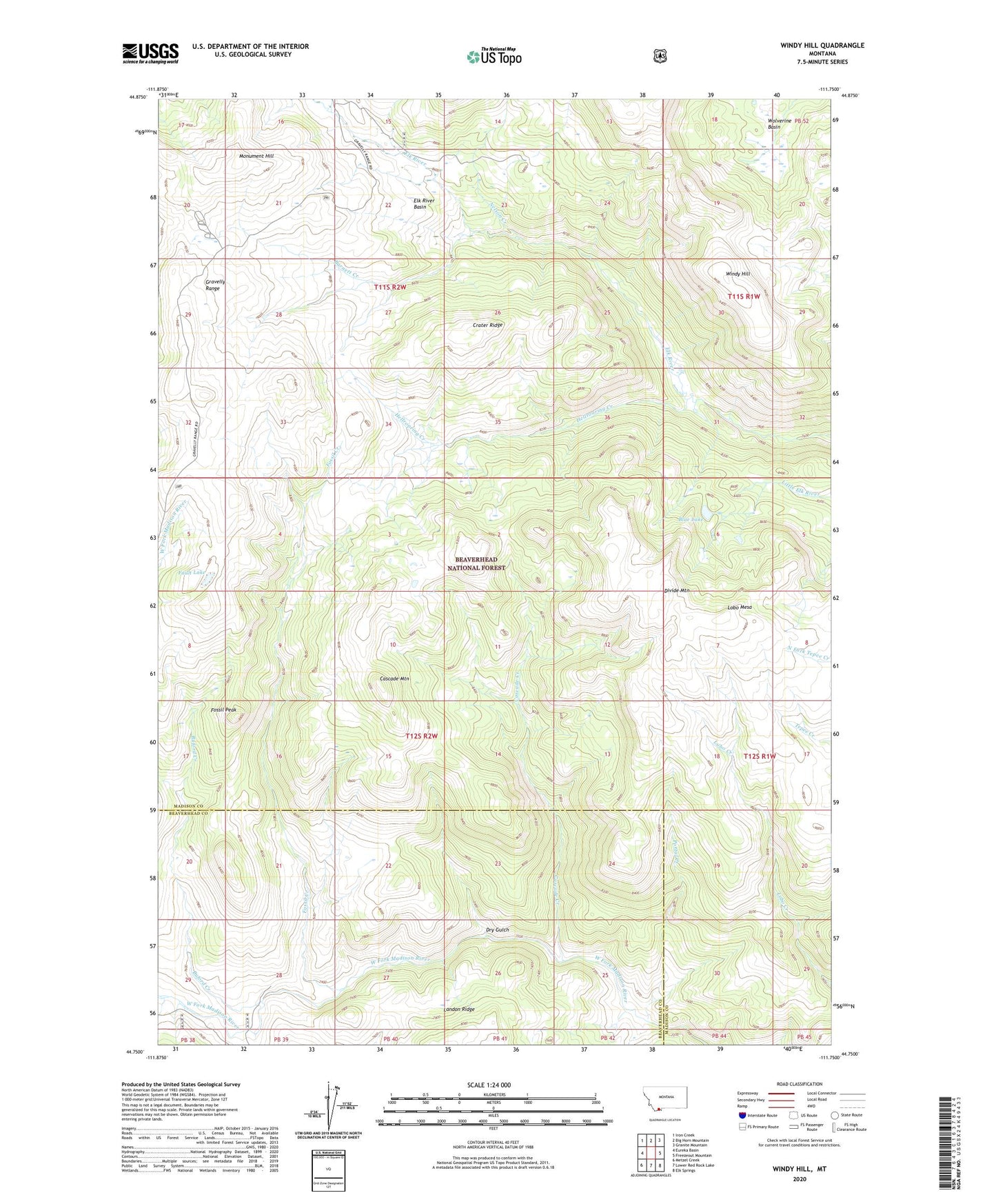
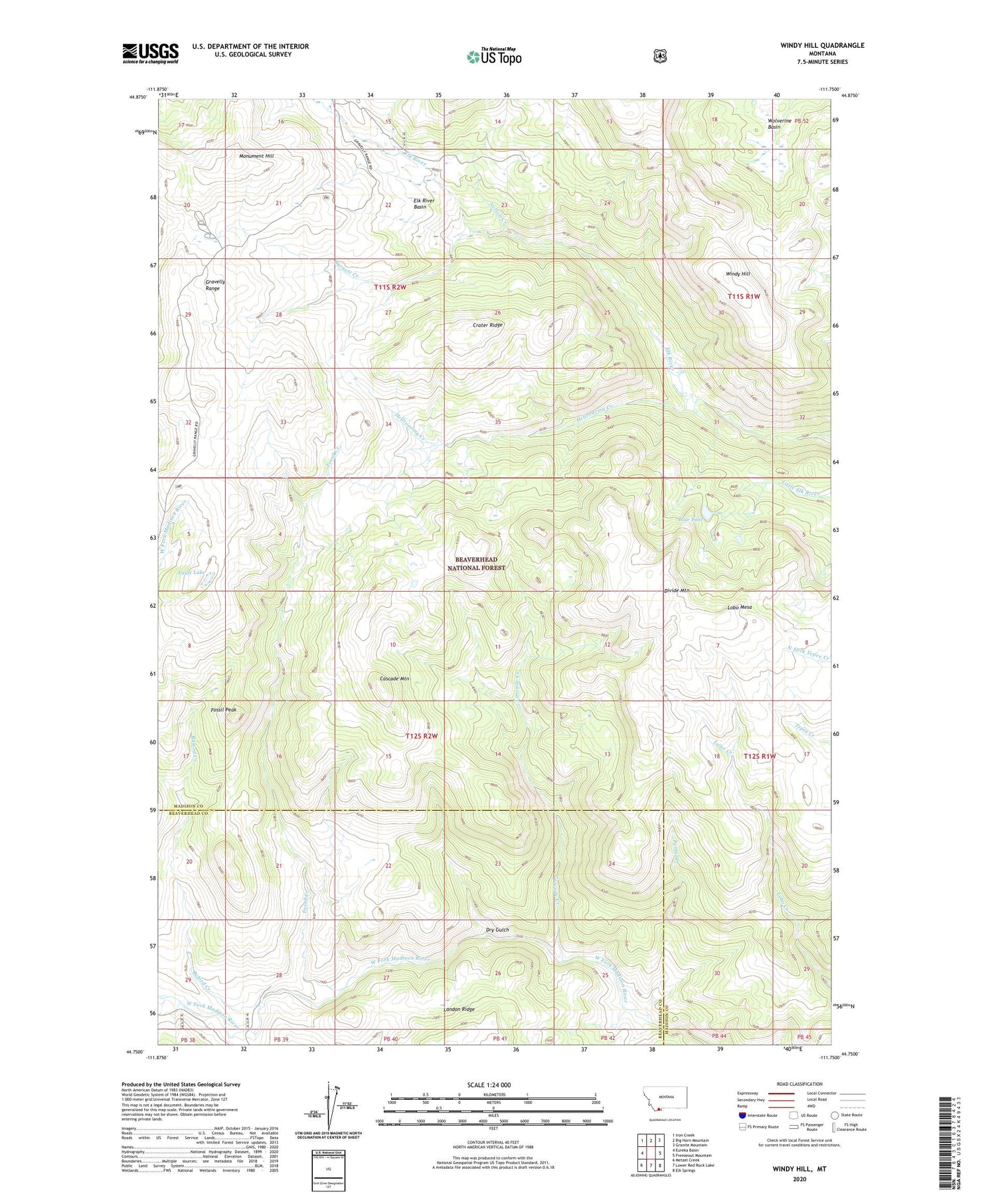
2020 topographic map quadrangle Windy Hill in the state of Montana. Scale: 1:24000. Based on the newly updated USGS 7.5' US Topo map series, this map is in the following counties: Madison, Beaverhead. The map contains contour data, water features, and other items you are used to seeing on USGS maps, but also has updated roads and other features. This is the next generation of topographic maps. Printed on high-quality waterproof paper with UV fade-resistant inks.
Quads adjacent to this one:
West: Eureka Basin
Northwest: Iron Creek
North: Big Horn Mountain
Northeast: Granite Mountain
East: Freezeout Mountain
Southeast: Elk Springs
South: Lower Red Rock Lake
Southwest: Metzel Creek
Contains the following named places: Barnett Creek, Blue Lake, Buford Creek, Cascade Creek, Cascade Mountain, Crater Ridge, Divide Mountain, Dry Gulch, Elk River Basin, Fault Lake, Fossil Creek, Fossil Peak, Gazelle Creek Pack Trail, Hellroaring Creek, Lobo Mesa, Lobo Mesa Pack Trail, Monument Hill, Nelson Creek, Portal Creek, Rossiter Creek, Windy Hill, Wolverine Basin