MyTopo
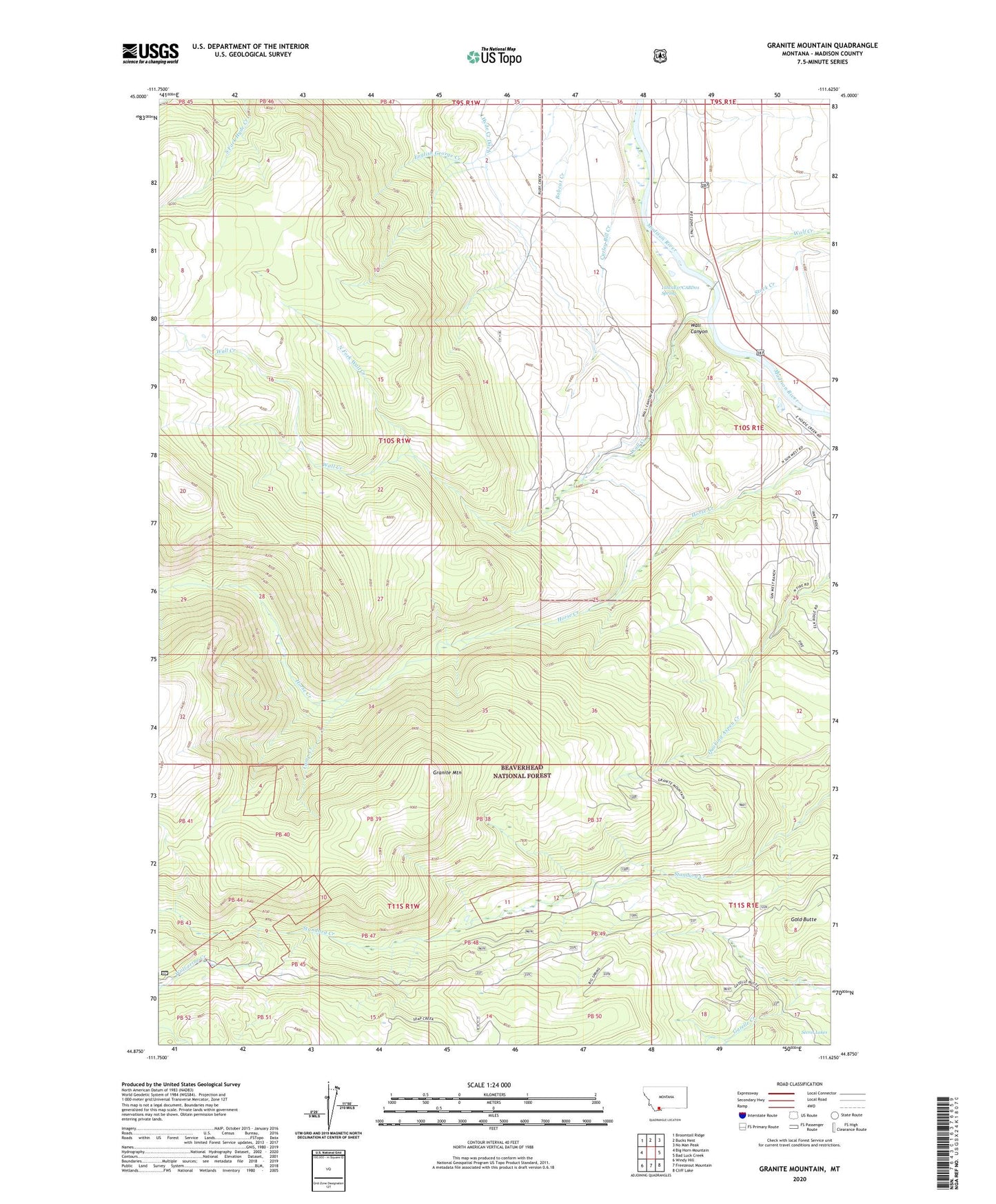
Granite Mountain Montana US Topo Map
Couldn't load pickup availability
Also explore the Granite Mountain Forest Service Topo of this same quad for updated USFS data
2024 topographic map quadrangle Granite Mountain in the state of Montana. Scale: 1:24000. Based on the newly updated USGS 7.5' US Topo map series, this map is in the following counties: Madison. The map contains contour data, water features, and other items you are used to seeing on USGS maps, but also has updated roads and other features. This is the next generation of topographic maps. Printed on high-quality waterproof paper with UV fade-resistant inks.
Quads adjacent to this one:
West: Big Horn Mountain
Northwest: Broomtail Ridge
North: Bucks Nest
Northeast: No Man Peak
East: Bad Luck Creek
Southeast: Cliff Lake
South: Freezeout Mountain
Southwest: Windy Hill
This map covers the same area as the classic USGS quad with code o44111h6.
Contains the following named places: 10S01E06BBBD01 Well, 10S01E06BBCC01 Well, 10S01E06CCB_01 Well, 10S01E07CABD01 Spring, 10S01E07DDB_01 Well, Camp Creek, Curley Bill Creek, Gold Butte, Granite Mountain, Kelly Ranch, Klatt Ranch, Moose Creek, North Fork Wall Creek, South Madison Campground, Stock Creek, Wall Canyon, Wall Creek, Wolf Creek, Wolf Creek Ranch, Wolverine Creek