MyTopo
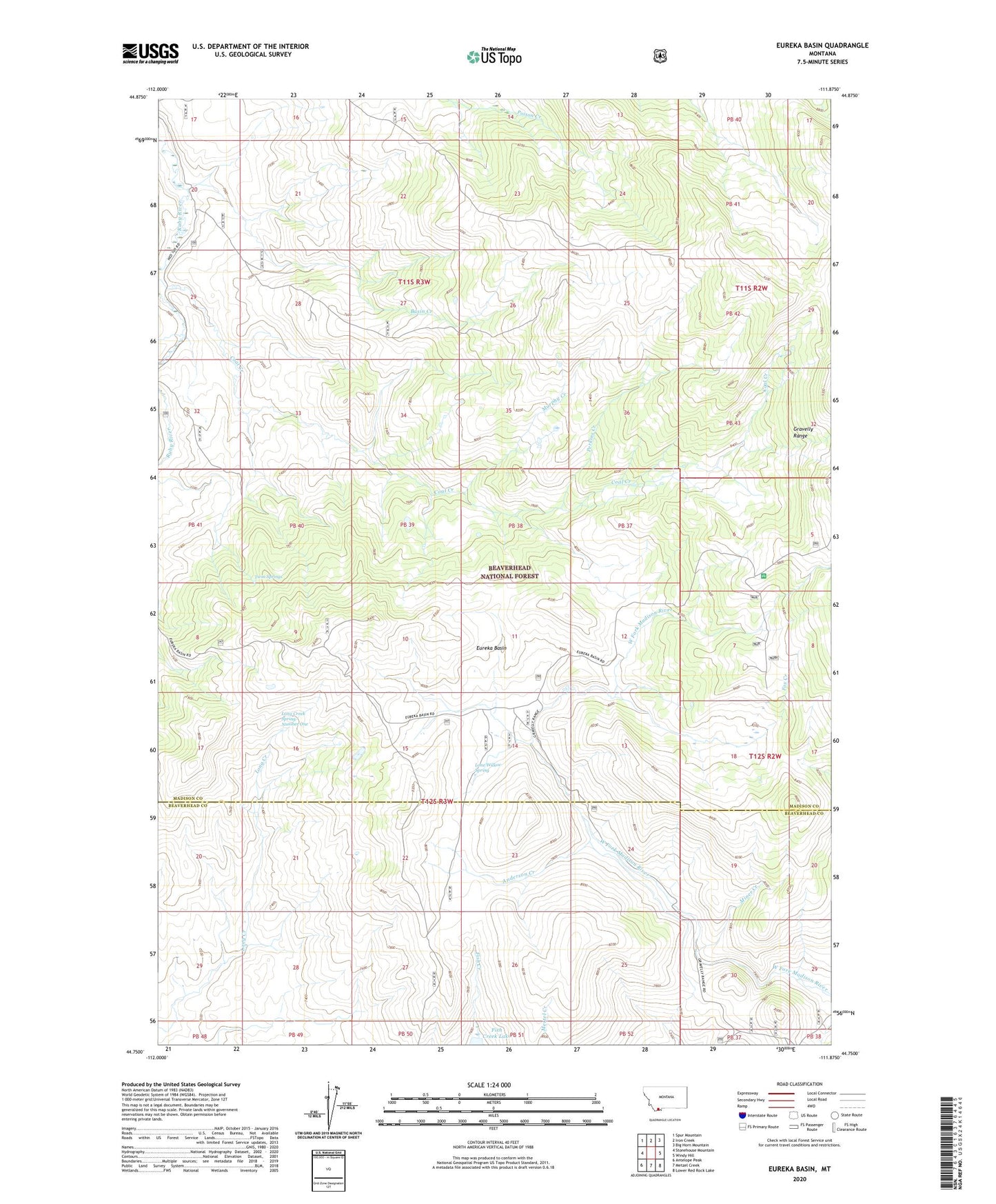
Eureka Basin Montana US Topo Map
Couldn't load pickup availability
Also explore the Eureka Basin Forest Service Topo of this same quad for updated USFS data
2024 topographic map quadrangle Eureka Basin in the state of Montana. Scale: 1:24000. Based on the newly updated USGS 7.5' US Topo map series, this map is in the following counties: Madison, Beaverhead. The map contains contour data, water features, and other items you are used to seeing on USGS maps, but also has updated roads and other features. This is the next generation of topographic maps. Printed on high-quality waterproof paper with UV fade-resistant inks.
Quads adjacent to this one:
West: Stonehouse Mountain
Northwest: Spur Mountain
North: Iron Creek
Northeast: Big Horn Mountain
East: Windy Hill
Southeast: Lower Red Rock Lake
South: Metzel Creek
Southwest: Antelope Peak
This map covers the same area as the classic USGS quad with code o44111g8.
Contains the following named places: Anderson Creek, Basin Creek, Coal Creek, Corral Creek, Eureka Basin, Fox Creek, Lone Willow Spring, Long Creek Spring Number One, Miner Creek, Murphy Creek, Perkins Creek, Shovel Creek, Twin Springs, West Fork Ranger Station, West Fork Rest Area, Williams Camp