MyTopo
Elk Springs Montana US Topo Map
Couldn't load pickup availability
Also explore the Elk Springs Forest Service Topo of this same quad for updated USFS data
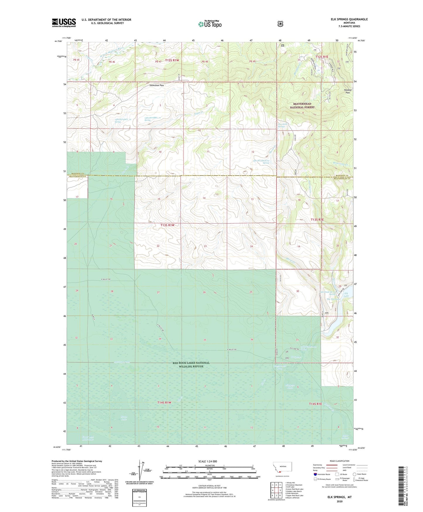
2024 topographic map quadrangle Elk Springs in the state of Montana. Scale: 1:24000. Based on the newly updated USGS 7.5' US Topo map series, this map is in the following counties: Beaverhead, Madison. The map contains contour data, water features, and other items you are used to seeing on USGS maps, but also has updated roads and other features. This is the next generation of topographic maps. Printed on high-quality waterproof paper with UV fade-resistant inks.
Quads adjacent to this one:
West: Lower Red Rock Lake
Northwest: Windy Hill
North: Freezeout Mountain
Northeast: Cliff Lake
East: Hidden Lake Bench
Southeast: Mount Jefferson
South: Upper Red Rock Lake
Southwest: Slide Mountain
This map covers the same area as the classic USGS quad with code o44111f6.
Contains the following named places: 13S01E29CAB_01 Spring, 13S01E31DCAB01 Spring, 13S01W04DCC_01 Spring, 13S01W10BBA_01 Spring, 13S01W12DAAC01 Spring, 13S01W27BBAC01 Well, 13S01W28BCBB01 Well, 13S01W28DDD_01 Well, Antelope Pond, Culver Springs, Culver Springs Dam, Elk Lake Recreation Site, Elk Springs, Hackett Creek, Hoodoo Pass, Horse Creek, Lobo Creek, MacDonald Pond, Narrows Creek, Selby Resort, Snowshoe Pass, Swan Lake, The Narrows, Two Drink Springs, Widgeon Pond, Widgeon Pond Dam