MyTopo
Yarger Butte Montana US Topo Map
Couldn't load pickup availability
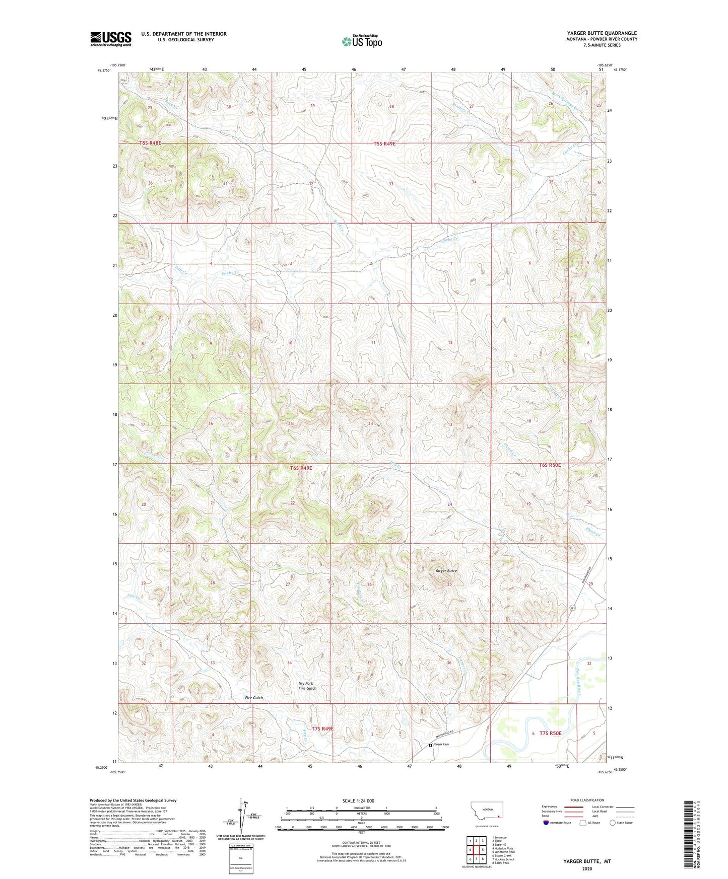
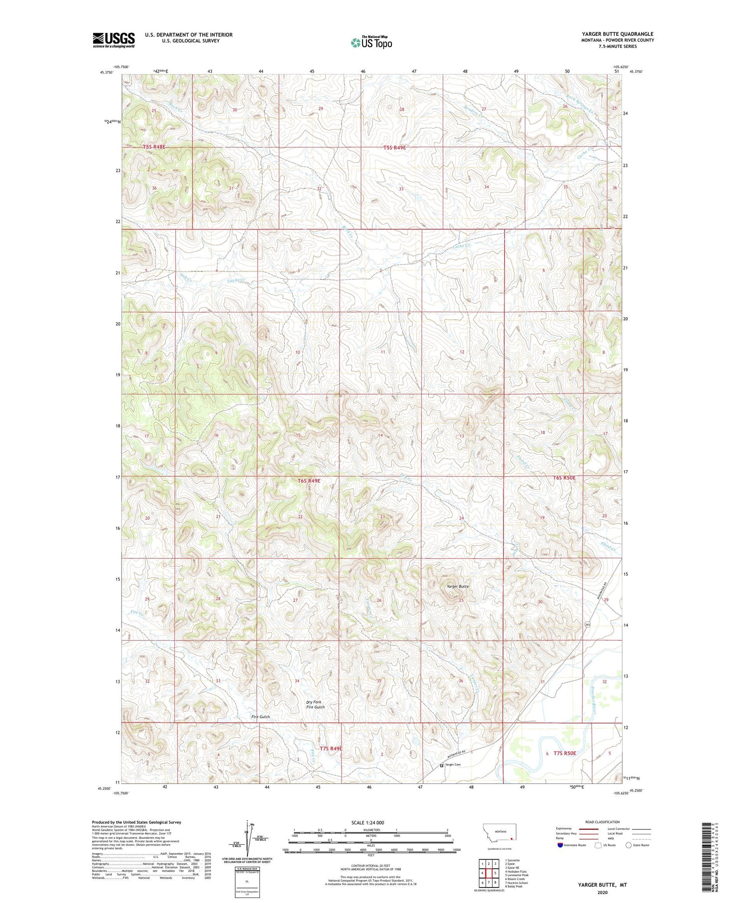
2020 topographic map quadrangle Yarger Butte in the state of Montana. Scale: 1:24000. Based on the newly updated USGS 7.5' US Topo map series, this map is in the following counties: Powder River. The map contains contour data, water features, and other items you are used to seeing on USGS maps, but also has updated roads and other features. This is the next generation of topographic maps. Printed on high-quality waterproof paper with UV fade-resistant inks.
Quads adjacent to this one:
West: Hodsdon Flats
Northwest: Sonnette
North: Epsie
Northeast: Epsie NE
East: Lonesome Peak
Southeast: Baldy Peak
South: Huckins School
Southwest: Bloom Creek
Contains the following named places: 05S49E32ADCD01 Well, 06S49E02CABB01 Well, 06S50E07BCBA01 Well, 06S50E31CDD_01 Well, 06S50E31DCC_02 Well, 06S50E31DCCD01 Well, 06S50E31DD__01 Well, 07S49E01BDDA01 Well, 07S49E13ABBB01 Well, Buck Creek, Dry Creek, Dry Fork Fire Gulch, E B Ranch Number 1 Dam, Rock Springs Creek, Salt Creek, Sanders Creek, Yarger Butte, Yarger Cemetery, Yarger Creek