MyTopo
Epsie Montana US Topo Map
Couldn't load pickup availability
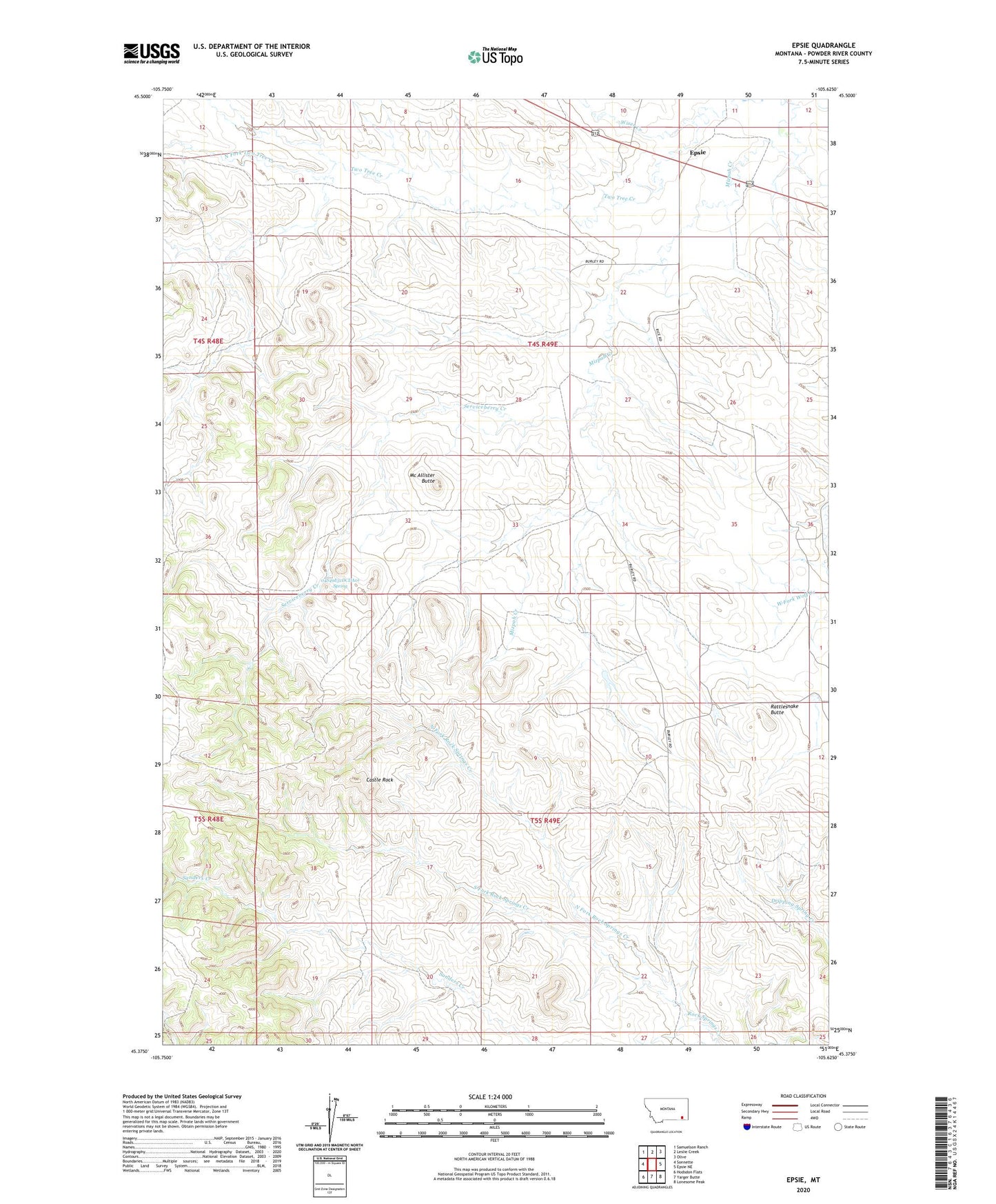
2024 topographic map quadrangle Epsie in the state of Montana. Scale: 1:24000. Based on the newly updated USGS 7.5' US Topo map series, this map is in the following counties: Powder River. The map contains contour data, water features, and other items you are used to seeing on USGS maps, but also has updated roads and other features. This is the next generation of topographic maps. Printed on high-quality waterproof paper with UV fade-resistant inks.
Quads adjacent to this one:
West: Sonnette
Northwest: Samuelson Ranch
North: Leslie Creek
Northeast: Olive
East: Epsie NE
Southeast: Lonesome Peak
South: Yarger Butte
Southwest: Hodsdon Flats
This map covers the same area as the classic USGS quad with code o45105d6.
Contains the following named places: 04S48E24ABDB01 Well, 04S49E08DCBD01 Well, 04S49E09DDDB01 Well, 04S49E14BABB01 Well, 04S49E14BCBD01 Well, 04S49E14CBCD01 Well, 04S49E14DBBD01 Well, 04S49E15ADCC01 Well, 04S49E15BDDC01 Well, 04S49E15BDDD01 Well, 04S49E16CCBB01 Well, 04S49E17CDAA01 Well, 04S49E18DAAA01 Well, 04S49E22ACBA01 Well, 04S49E22ACBB01 Well, 04S49E22ACBB02 Well, 04S49E22BADD01 Well, 04S49E22DCAB01 Well, 04S49E23ACAC01 Well, 04S49E23CADD01 Well, 04S49E25BBDD01 Well, 04S49E31CCCC01 Well, 04S49E31DAAA01 Well, 04S49E31DCDA01 Spring, 04S49E33BBDA01 Well, 04S49E34BACA01 Well, 05S49E03ABDB01 Well, 05S49E05BABD01 Well, 05S49E10DAAA01 Well, 05S49E15ACCC01 Well, 05S49E19ADBA01 Well, Castle Rock, Epsie, Mc Allister Butte, North Fork Rock Springs Creek, North Fork Two Tree Creek, Powder River County, Rattlesnake Butte, Serviceberry Creek, South Fork Rock Springs Creek, Two Tree Creek, Wiser Creek