MyTopo
Clarkson Nebraska US Topo Map
Couldn't load pickup availability
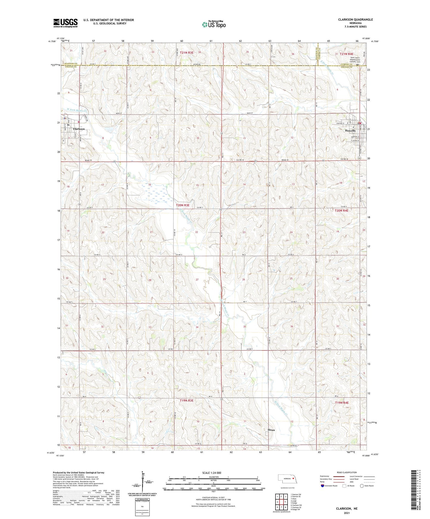
2021 topographic map quadrangle Clarkson in the state of Nebraska. Scale: 1:24000. Based on the newly updated USGS 7.5' US Topo map series, this map is in the following counties: Colfax, Stanton, Cuming. The map contains contour data, water features, and other items you are used to seeing on USGS maps, but also has updated roads and other features. This is the next generation of topographic maps. Printed on high-quality waterproof paper with UV fade-resistant inks.
Quads adjacent to this one:
West: Leigh
Northwest: Stanton SW
North: Stanton SE
Northeast: Aloys
East: Dodge
Southeast: Dodge SW
South: Clarkson SE
Southwest: Clarkson SW
This map covers the same area as the classic USGS quad with code o41097f1.
Contains the following named places: Adams Election Precinct, City of Clarkson, Clarkson, Clarkson City Park, Clarkson City Park Campground, Clarkson Historical Museum, Clarkson Medical Clinic, Clarkson Memorial Library, Clarkson Police Department, Clarkson Post Office, Clarkson Public Schools, Clarkson Volunteer Fire and Rescue, Colonial Manor, Farmers Union Co-op Supply Company Elevator, Heun, Heun Post Office, Holy Trinity Catholic Church, Howells, Howells Chiropractic Clinic, Howells Community Catholic School - Center One, Howells Community Catholic School - Center Two, Howells Community Health Center, Howells Museum, Howells Police Department, Howells Post Office, Howells Public Library, Howells Public Park, Howells Public Park Campground, Howells Public Schools, Howells Rescue Squad, Howells Retirement Center, Howells Volunteer Fire Department, Memorial Park, Saint John Nepomucene Catholic Church, Saint John's Nepomucene Catholic Cemetery, Saints Peter and Paul Catholic Church, School Number 14, School Number 38, School Number 47, School Number 48, School Number 53, Township of Adams, Trinity Lutheran Church, Village of Howells, Zion Church, ZIP Code: 68641