MyTopo
Amboy Nebraska US Topo Map
Couldn't load pickup availability
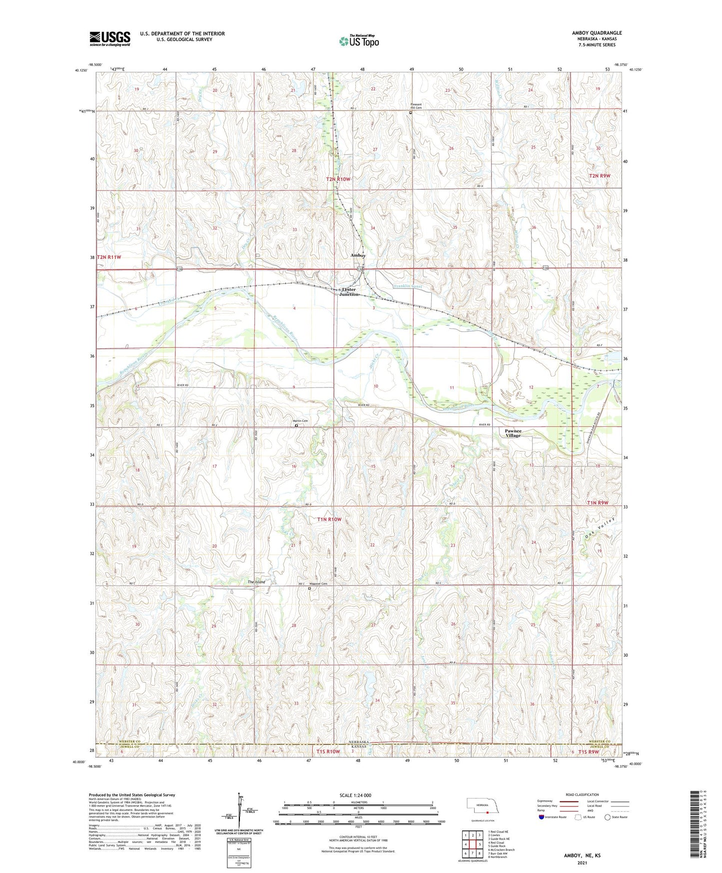
2021 topographic map quadrangle Amboy in the state of Nebraska. Scale: 1:24000. Based on the newly updated USGS 7.5' US Topo map series, this map is in the following counties: Webster, Jewell. The map contains contour data, water features, and other items you are used to seeing on USGS maps, but also has updated roads and other features. This is the next generation of topographic maps. Printed on high-quality waterproof paper with UV fade-resistant inks.
Quads adjacent to this one:
West: Red Cloud
Northwest: Red Cloud NE
North: Cowles
Northeast: Guide Rock NE
East: Guide Rock
Southeast: Northbranch
South: Burr Oak NW
Southwest: McCracken Branch
Contains the following named places: Advent Creek, Amboy, Amboy Post Office, Benjamin Wagoner Memorial Cemetery Historical Marker, Crooked Creek, Dry Creek, Elm Creek, Elm Creek State Wildlife Management Area, Guide Rock Election Precinct, Hicks Creek, Lester Junction, Lost Creek, Martin Cemetery, Oak Creek, Pawnee Village, Pleasant Hill Cemetery, Red Cloud Golf Club, Starke Round Barn, Superior-Courtland Dam, The Island, Wagoner Cemetery