MyTopo
Arcadia West Nebraska US Topo Map
Couldn't load pickup availability
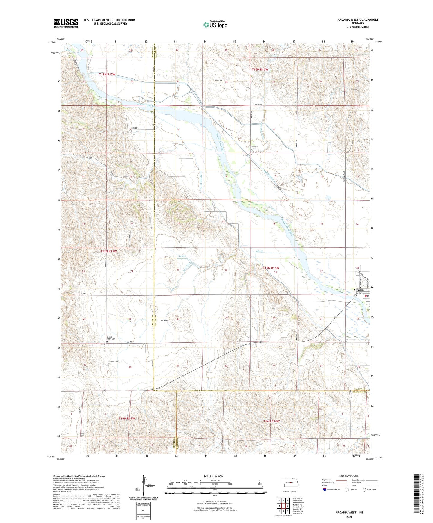
2021 topographic map quadrangle Arcadia West in the state of Nebraska. Scale: 1:24000. Based on the newly updated USGS 7.5' US Topo map series, this map is in the following counties: Valley, Custer, Sherman. The map contains contour data, water features, and other items you are used to seeing on USGS maps, but also has updated roads and other features. This is the next generation of topographic maps. Printed on high-quality waterproof paper with UV fade-resistant inks.
Quads adjacent to this one:
West: Ansley NE
Northwest: Sargent SE
North: Comstock
Northeast: Comstock SE
East: Arcadia East
Southeast: Arcadia SE
South: Arcadia SW
Southwest: Ansley SE
This map covers the same area as the classic USGS quad with code o41099d2.
Contains the following named places: Arcadia, Arcadia Centennial Historical Marker, Arcadia City Police Department, Arcadia Clinic, Arcadia Diversion Dam, Arcadia Diversion Dam State Wildlife Management Area, Arcadia Post Office, Arcadia Public Schools, Arcadia Township Library, Arcadia Volunteer Fire and Rescue, Arcadia Wayside Park, Cottonwood Creek, Dunham School, East Side School, Harry Ritz Detention Dam, Knight School, Lee Creek, Lee Park, Lee Park Cemetery, Lee Park Post Office, Lewin Reservoir, Ohme School, Rosebud School, Sacred Heart Cemetery, School Number 11, School Number 25, School Number 60, Spring Creek, Township of Arcadia, United Methodist Church, Village of Arcadia, ZIP Code: 68815