MyTopo
Comstock Nebraska US Topo Map
Couldn't load pickup availability
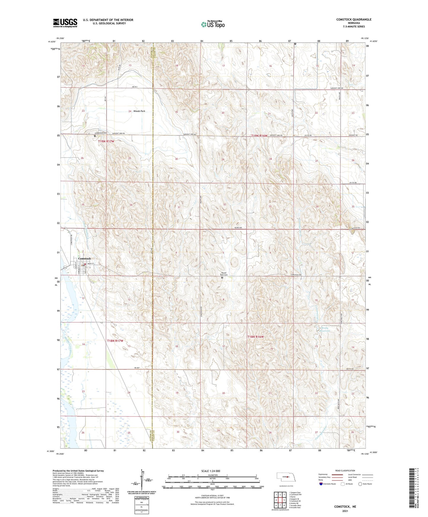
2021 topographic map quadrangle Comstock in the state of Nebraska. Scale: 1:24000. Based on the newly updated USGS 7.5' US Topo map series, this map is in the following counties: Valley, Custer. The map contains contour data, water features, and other items you are used to seeing on USGS maps, but also has updated roads and other features. This is the next generation of topographic maps. Printed on high-quality waterproof paper with UV fade-resistant inks.
Quads adjacent to this one:
West: Sargent SE
Northwest: Sargent East
North: Comstock NW
Northeast: Elyria
East: Comstock SE
Southeast: Arcadia East
South: Arcadia West
Southwest: Ansley NE
This map covers the same area as the classic USGS quad with code o41099e2.
Contains the following named places: Comstock, Comstock Post Office, Comstock Rural Fire Protection District, Comstock School, Comstock United Methodist Church, Czech National Cemetery, Geranium, Geranium Church, Geranium Post Office, Geranium School, Hruby Dam, Hruby Reservoir, Lone Star School, Longwood Cemetery, Longwood Post Office, Longwood School, Pleasant View School, Round Park Cemetery, Round Park School, School Number 110, School Number 19, Township of Comstock, Township of Geranium, Township of Liberty, Village of Comstock, Westcott Baptist Church, Woods Park, ZIP Code: 68828