MyTopo
Sargent SE Nebraska US Topo Map
Couldn't load pickup availability
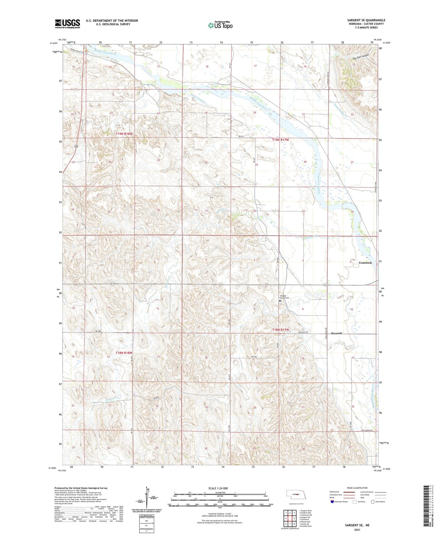
2021 topographic map quadrangle Sargent SE in the state of Nebraska. Scale: 1:24000. Based on the newly updated USGS 7.5' US Topo map series, this map is in the following counties: Custer. The map contains contour data, water features, and other items you are used to seeing on USGS maps, but also has updated roads and other features. This is the next generation of topographic maps. Printed on high-quality waterproof paper with UV fade-resistant inks.
Quads adjacent to this one:
West: Sargent SW
Northwest: Sargent West
North: Sargent East
Northeast: Comstock NW
East: Comstock
Southeast: Arcadia West
South: Ansley NE
Southwest: Westerville
This map covers the same area as the classic USGS quad with code o41099e3.
Contains the following named places: Big Oak Canyon, Canal Number 1, Canal Number 2, Douglas Grove Cemetery, Glazier School, Hyde Ranch Airport, Mills School, School Number 143, School Number 52, Stokes School, The Dowse Sod House, Township of Douglas Grove, Wagner Creek, Wescott, Wescott Post Office, Westcott School