MyTopo
Axtell NW Kansas US Topo Map
Couldn't load pickup availability
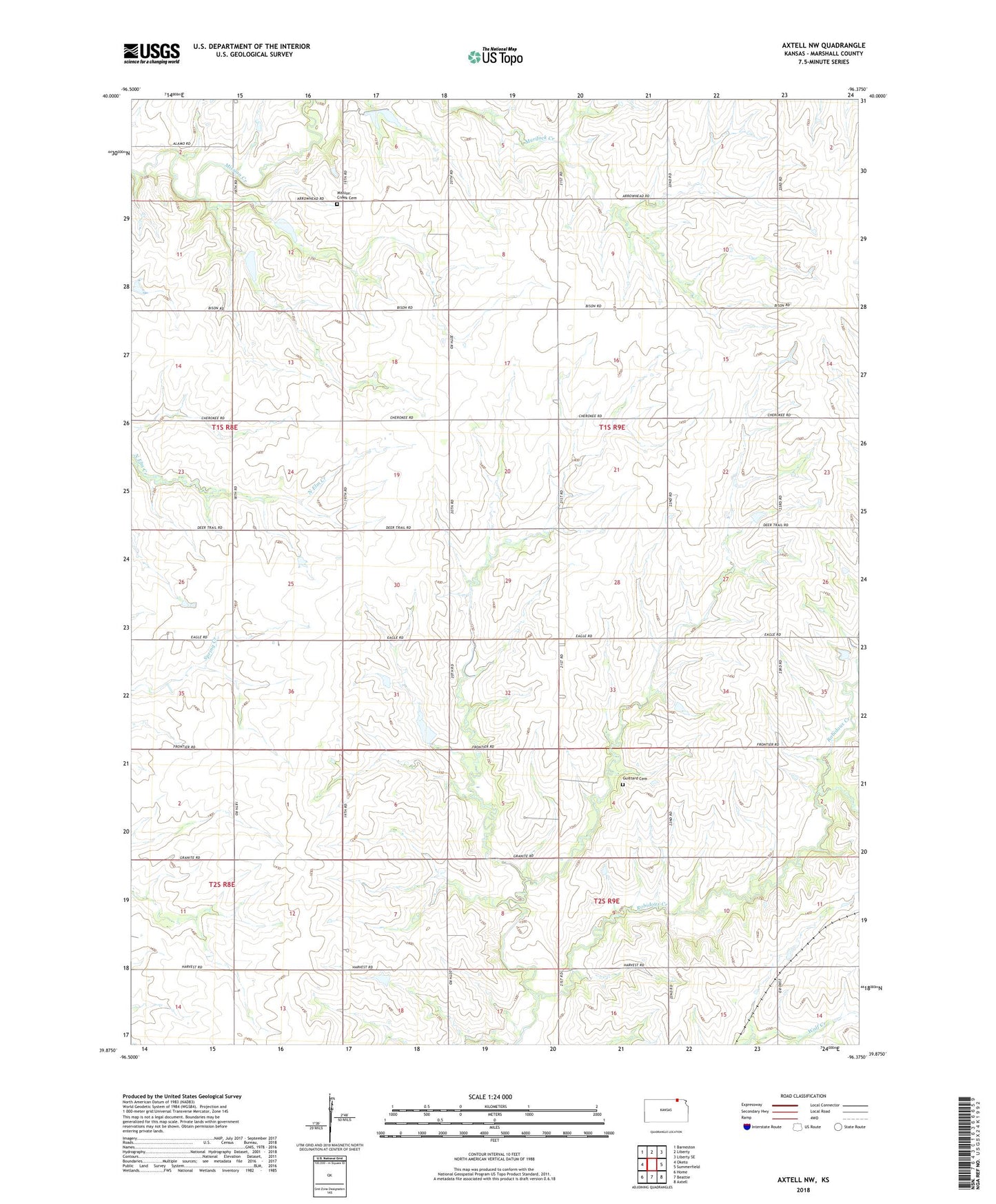
2022 topographic map quadrangle Axtell NW in the state of Kansas. Scale: 1:24000. Based on the newly updated USGS 7.5' US Topo map series, this map is in the following counties: Marshall. The map contains contour data, water features, and other items you are used to seeing on USGS maps, but also has updated roads and other features. This is the next generation of topographic maps. Printed on high-quality waterproof paper with UV fade-resistant inks.
Quads adjacent to this one:
West: Oketo
Northwest: Barneston
North: Liberty
Northeast: Liberty SE
East: Summerfield
Southeast: Axtell
South: Beattie
Southwest: Home
This map covers the same area as the classic USGS quad with code o39096h4.
Contains the following named places: Beattie Elementary School, Guittard Cemetery, Guittard Station, Mission Creek Cemetery, Mission Creek Community Center, Richland Center Church, Township of Richland, Westella, ZIP Code: 66406