MyTopo
Bartlett Nebraska US Topo Map
Couldn't load pickup availability
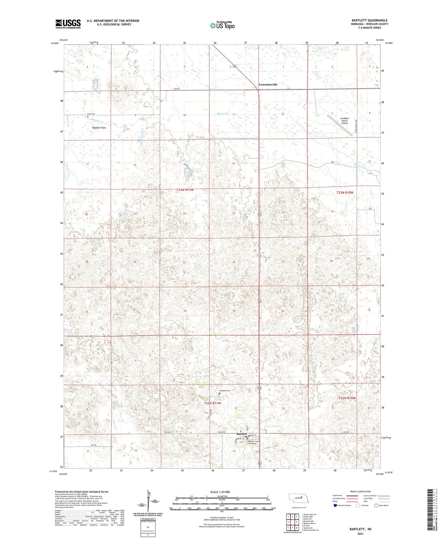
2021 topographic map quadrangle Bartlett in the state of Nebraska. Scale: 1:24000. Based on the newly updated USGS 7.5' US Topo map series, this map is in the following counties: Wheeler. The map contains contour data, water features, and other items you are used to seeing on USGS maps, but also has updated roads and other features. This is the next generation of topographic maps. Printed on high-quality waterproof paper with UV fade-resistant inks.
Quads adjacent to this one:
West: Bartlett NW
Northwest: Goose Lake SW
North: Goose Lake
Northeast: Deloit SW
East: Mignery Ranch
Southeast: School Number 20
South: Bartlett SE
Southwest: Ericson
This map covers the same area as the classic USGS quad with code o41098h5.
Contains the following named places: Bartlett, Bartlett Cemetery, Bartlett Election Precinct, Bartlett Post Office, Bartlett Volunteer Fire Department, Cumminsville, Cummunsville Post Office, Headquarters School, Landgren Ranch Airport, Our Savior Lutheran Church, Red Top School, Village of Bartlett, Wheeler Central Schools, Wheeler County, Wheeler County Court House, Wheeler County Sheriff's Office, ZIP Code: 68622