MyTopo
Ericson Nebraska US Topo Map
Couldn't load pickup availability
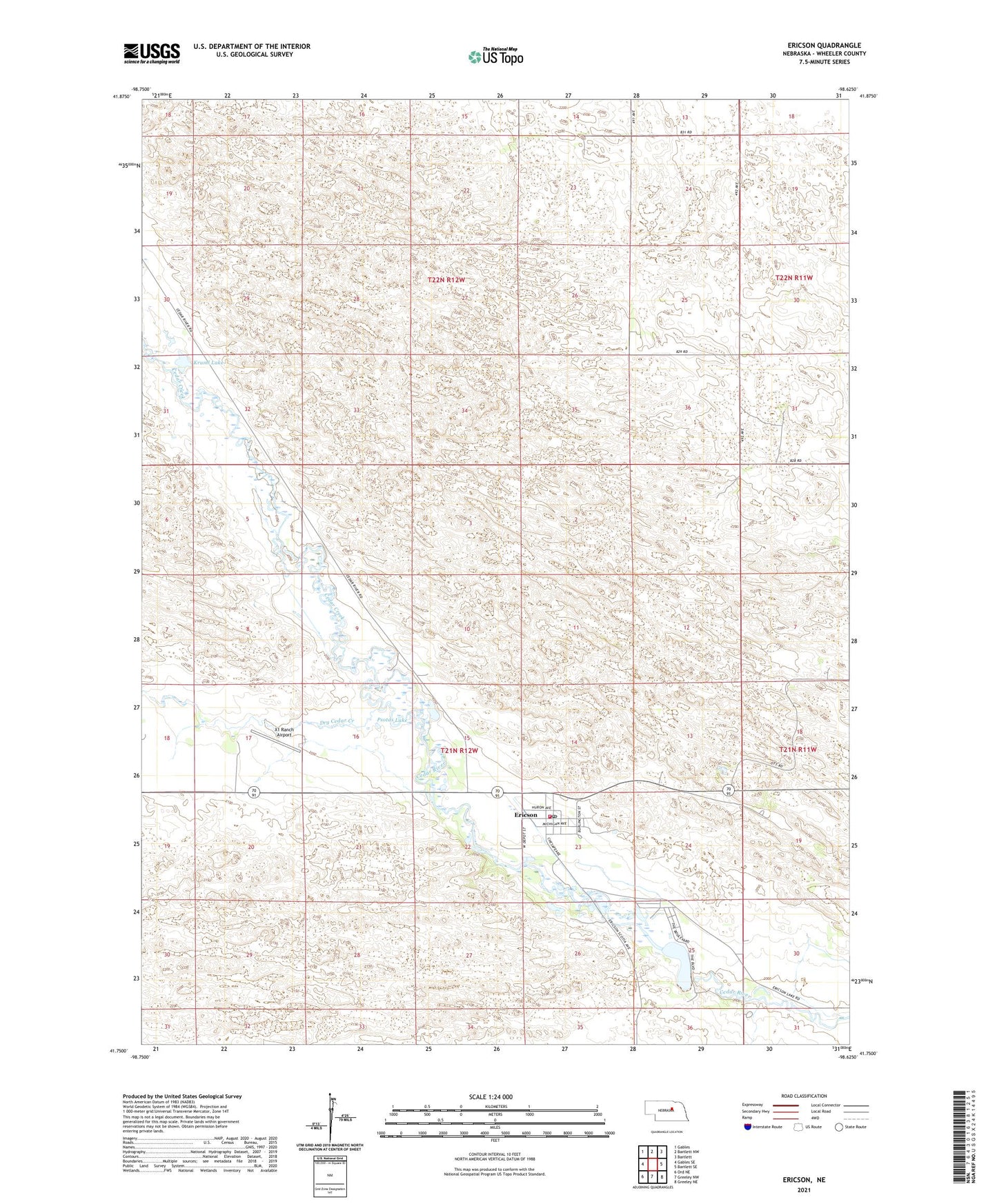
2021 topographic map quadrangle Ericson in the state of Nebraska. Scale: 1:24000. Based on the newly updated USGS 7.5' US Topo map series, this map is in the following counties: Wheeler. The map contains contour data, water features, and other items you are used to seeing on USGS maps, but also has updated roads and other features. This is the next generation of topographic maps. Printed on high-quality waterproof paper with UV fade-resistant inks.
Quads adjacent to this one:
West: Gables SE
Northwest: Gables
North: Bartlett NW
Northeast: Bartlett
East: Bartlett SE
Southeast: Greeley NE
South: Greeley NW
Southwest: Ord NE
This map covers the same area as the classic USGS quad with code o41098g6.
Contains the following named places: Cedar Creek, Dry Cedar Creek, Ericson, Ericson Dam, Ericson Election Precinct, Ericson Grade School, Ericson Lake, Ericson Post Office, Ericson Reservoir, Ericson Volunteer Fire Department, Howart Lakes, Kruml Lake, Psotas Lake, Saint Theresas Catholic Church, Sandhills Baptist Fellowship, School Number 32, School Number 42, Village of Ericson, X1 Ranch Airport