MyTopo
Battle Creek Nebraska US Topo Map
Couldn't load pickup availability
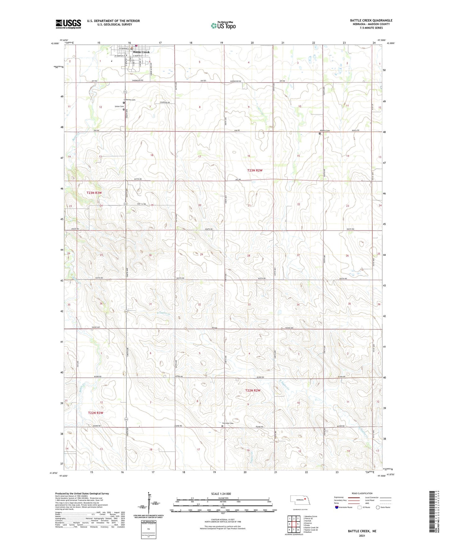
2021 topographic map quadrangle Battle Creek in the state of Nebraska. Scale: 1:24000. Based on the newly updated USGS 7.5' US Topo map series, this map is in the following counties: Madison. The map contains contour data, water features, and other items you are used to seeing on USGS maps, but also has updated roads and other features. This is the next generation of topographic maps. Printed on high-quality waterproof paper with UV fade-resistant inks.
Quads adjacent to this one:
West: Emerick
Northwest: Meadow Grove
North: Pierce SE
Northeast: Norfolk
East: Enola
Southeast: Madison
South: Battle Creek SE
Southwest: Battle Creek SW
Contains the following named places: Allbery Cemetery, Allbery School, Battle Creek, Battle Creek City Park, Battle Creek Election Precinct, Battle Creek Elementary School, Battle Creek Municipal Park Campground, Battle Creek Police Department, Battle Creek Post Office, Battle Creek Public Library, Battle Creek Volunteer Fire and Rescue, City of Battle Creek, Community Pride Care Center, Evergreen Hill Golf Course, Fairview, Fairview Cemetery, Fairview Church, KNEN-FM (Norfolk), Lutheran Cemetery, Madison County, Oak Valley State Wildlife Management Area, Parks of Pride Arboretum, Saint John Lutheran School, Saint Johns Lutheran Church, Saint Peters School, School Number 22, School Number 66, School Number 88, Union Cemetery, United Methodist Church, ZIP Code: 68715