MyTopo
Bayard SW Nebraska US Topo Map
Couldn't load pickup availability
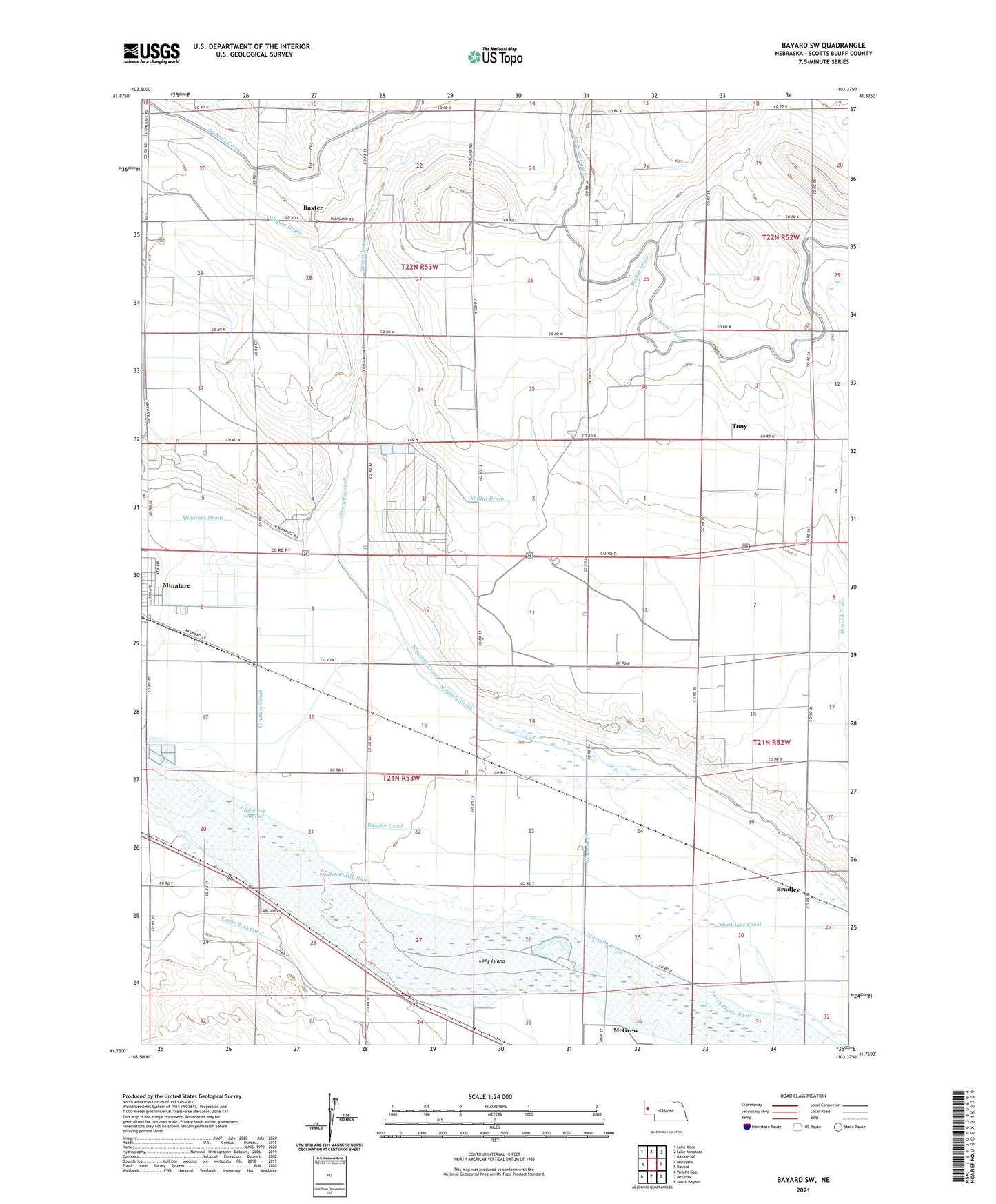
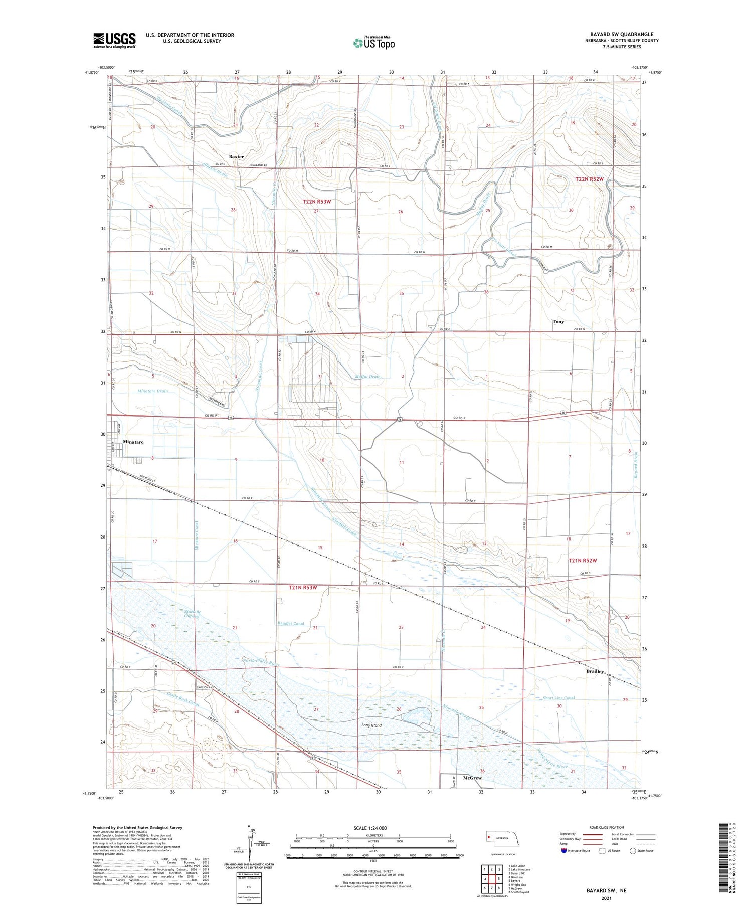
2021 topographic map quadrangle Bayard SW in the state of Nebraska. Scale: 1:24000. Based on the newly updated USGS 7.5' US Topo map series, this map is in the following counties: Scotts Bluff. The map contains contour data, water features, and other items you are used to seeing on USGS maps, but also has updated roads and other features. This is the next generation of topographic maps. Printed on high-quality waterproof paper with UV fade-resistant inks.
Quads adjacent to this one:
West: Minatare
Northwest: Lake Alice
North: Lake Minatare
Northeast: Bayard NE
East: Bayard
Southeast: South Bayard
South: McGrew
Southwest: Wright Gap
Contains the following named places: Adventist Church, Alliance Drain, Bastron Lake, Baxter, Baxter Post Office, Bayard Drain, Bradley, Castle Rock Canal, Harrys RV Park, Highland School, Long Island, Minatare Canal, Minatare Drain, Moffat Drain, Ninemile Channel, Ninemile Creek, Rangler Canal, Tony