MyTopo
Wright Gap Nebraska US Topo Map
Couldn't load pickup availability
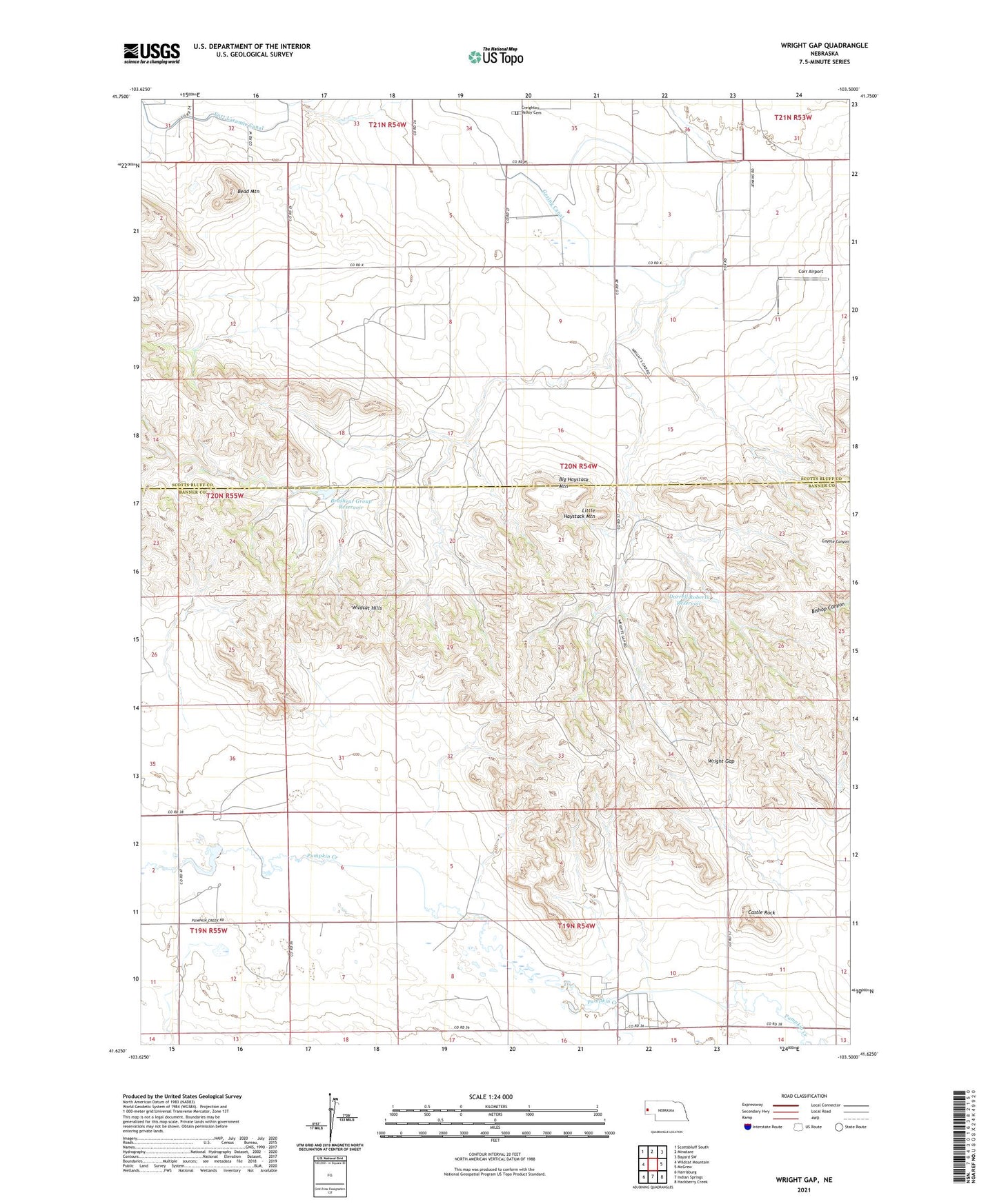
2021 topographic map quadrangle Wright Gap in the state of Nebraska. Scale: 1:24000. Based on the newly updated USGS 7.5' US Topo map series, this map is in the following counties: Banner, Scotts Bluff. The map contains contour data, water features, and other items you are used to seeing on USGS maps, but also has updated roads and other features. This is the next generation of topographic maps. Printed on high-quality waterproof paper with UV fade-resistant inks.
Quads adjacent to this one:
West: Wildcat Mountain
Northwest: Scottsbluff South
North: Minatare
Northeast: Bayard SW
East: McGrew
Southeast: Hackberry Creek
South: Indian Springs
Southwest: Harrisburg
This map covers the same area as the classic USGS quad with code o41103f5.
Contains the following named places: Bead Mountain, Big Haystack Mountain, Brashear Group Dam, Brashear Group Reservoir, Cannell Dam East, Cannell Dam West, Cannell Reservoir East, Cannell Reservoir West, Castle Rock, Castle Rock Election Precinct, Corr Airport, Creighton Valley Cemetery, Darrell Roberts Dam, Darrell Roberts Reservoir, Indian Springs Creek, Little Haystack Mountain, Wright Gap