MyTopo
Minatare Nebraska US Topo Map
Couldn't load pickup availability
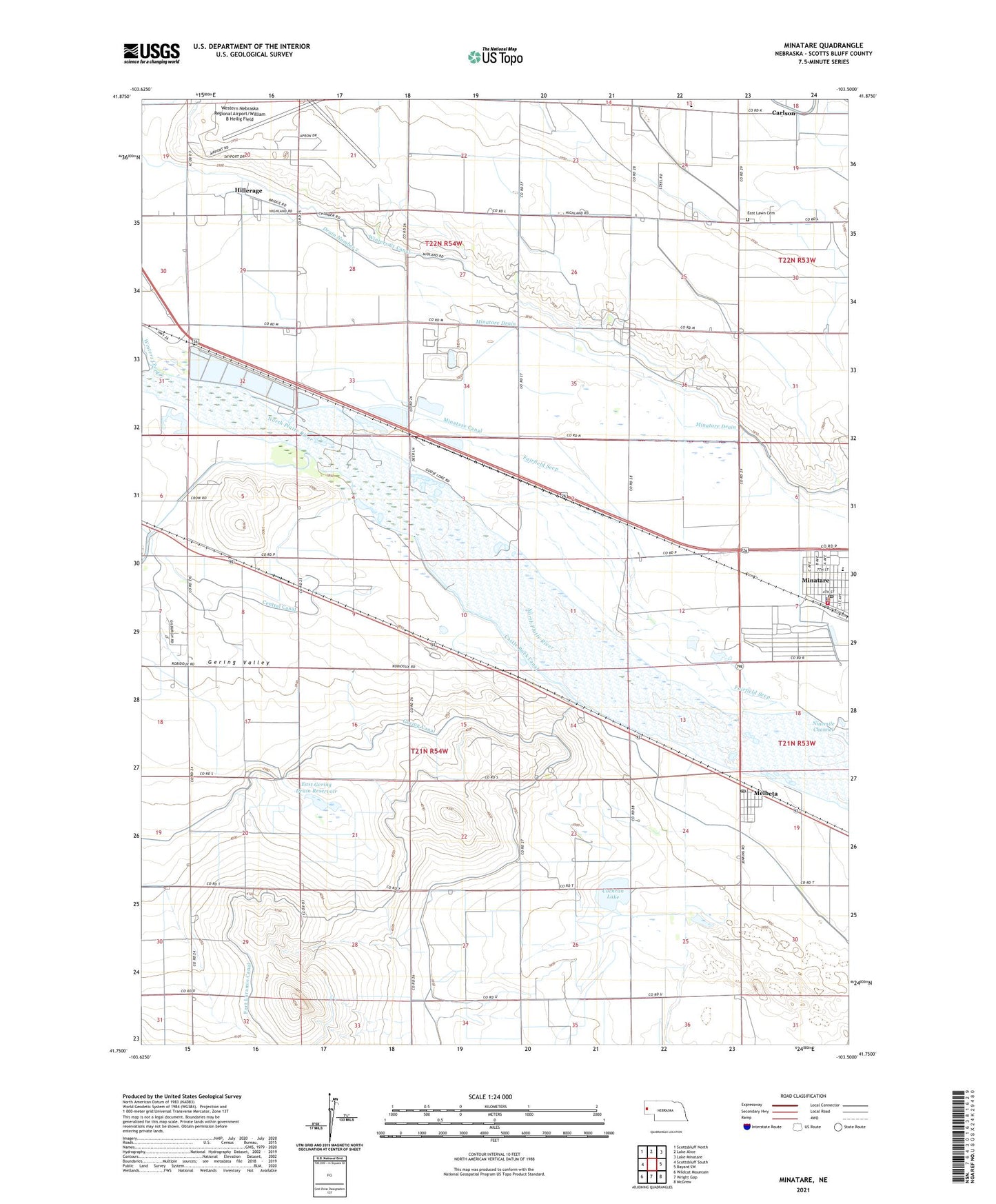
2021 topographic map quadrangle Minatare in the state of Nebraska. Scale: 1:24000. Based on the newly updated USGS 7.5' US Topo map series, this map is in the following counties: Scotts Bluff. The map contains contour data, water features, and other items you are used to seeing on USGS maps, but also has updated roads and other features. This is the next generation of topographic maps. Printed on high-quality waterproof paper with UV fade-resistant inks.
Quads adjacent to this one:
West: Scottsbluff South
Northwest: Scottsbluff North
North: Lake Alice
Northeast: Lake Minatare
East: Bayard SW
Southeast: McGrew
South: Wright Gap
Southwest: Wildcat Mountain
This map covers the same area as the classic USGS quad with code o41103g5.
Contains the following named places: Assembly of God Church, Brockhoff, Carlson, Central Canal, City of Minatare, Cochran Lake, Drain Number 2, East Gering Drain Dam, East Gering Drain Reservoir, East Lawn Cemetery, Fairfield Seep, Fairview School, Ficklin Springs, Gering Canal, Gering Valley, Harrys Mobile Home Incorporated, Hillerage, Kelley Bean Company Incorporated Elevator, Melbeta, Melbeta Post Office, Minatare, Minatare Elementary School, Minatare Feedlot, Minatare High School, Minatare Melbeta Volunteer Fire Department Station 1 Headquarters, Minatare Melbeta Volunteer Fire Department Station 2, Minatare Police Department, Minatare Post Office, Minatare Public Library, Presbyterian Community Church, Scottsbluff Army Air Field, Scottsbluff Army Airfield Historical Marker, Valley View School, Village of Melbeta, Western Nebraska Regional Airport Crash Rescue, Western Nebraska Regional Airport/William B Heilig Field, Winters, Winters Creek, Winters Creek Canal, ZIP Code: 69355