MyTopo
Lake Alice Nebraska US Topo Map
Couldn't load pickup availability
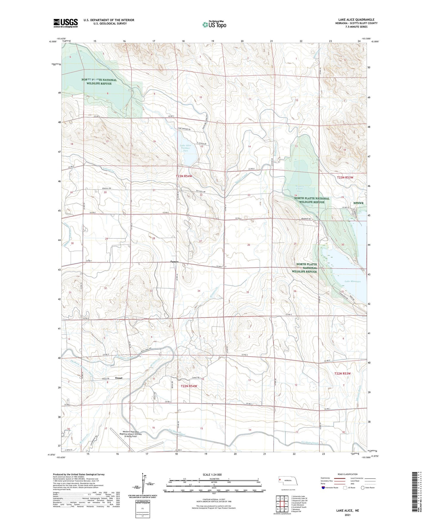
2021 topographic map quadrangle Lake Alice in the state of Nebraska. Scale: 1:24000. Based on the newly updated USGS 7.5' US Topo map series, this map is in the following counties: Scotts Bluff. The map contains contour data, water features, and other items you are used to seeing on USGS maps, but also has updated roads and other features. This is the next generation of topographic maps. Printed on high-quality waterproof paper with UV fade-resistant inks.
Quads adjacent to this one:
West: Scottsbluff North
Northwest: University Lake
North: University Lake SE
Northeast: Kilpatrick Lake SW
East: Lake Minatare
Southeast: Bayard SW
South: Minatare
Southwest: Scottsbluff South
This map covers the same area as the classic USGS quad with code o41103h5.
Contains the following named places: Dewey Tabor Election Precinct, Dunham Andrews Drain, East Winters Creek Election Precinct, Gueck Ranch, Hillcrest School, James, Lake Alice, Lake Alice Lower Dam, Lake Alice Number Two, Lake Alice School, Lake Minatare State Recreation Area, Lakeview Point Campground, Minatare Dam, North Platte National Wildlife Refuge, Scouts Rest Campground, Supply Canal, Tri-State Canal, Trout, West Wind Campground, Winters Creek Lake, ZIP Code: 69361