MyTopo
Beemer Nebraska US Topo Map
Couldn't load pickup availability
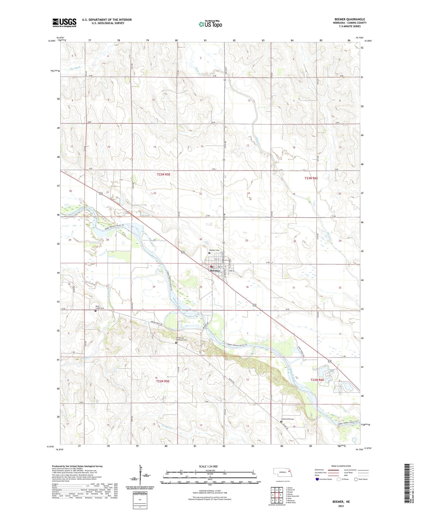
2021 topographic map quadrangle Beemer in the state of Nebraska. Scale: 1:24000. Based on the newly updated USGS 7.5' US Topo map series, this map is in the following counties: Cuming. The map contains contour data, water features, and other items you are used to seeing on USGS maps, but also has updated roads and other features. This is the next generation of topographic maps. Printed on high-quality waterproof paper with UV fade-resistant inks.
Quads adjacent to this one:
West: Wisner
Northwest: Altona
North: Altona SE
Northeast: Pender
East: West Point NW
Southeast: West Point
South: Monterey
Southwest: Aloys
Contains the following named places: Beemer, Beemer Cemetery, Beemer City Park, Beemer Medical Clinic, Beemer Police Department, Beemer Post Office, Beemer Public Schools, Beemer Volunteer Fire Department, Bismarck, Colonial Haven, Cuming County, Farmers Elevator Incorporated Elevator, First Congregational Church, Greenwood Cemetery, Holy Cross Church, Immanuel Lutheran Cemetery, Immanuel Lutheran Church, Immanuel School, Indian Trails Country Club, Karlen Memorial Library, Mennonite Church, Rock Creek, Rock Creek Cemetery, Saint Johns Church, School Number 19, School Number 3, School Number 31, School Number 6, School Number 7, Township of Beemer, United Methodist Church, Village of Beemer, ZIP Code: 68716