MyTopo
Pender Nebraska US Topo Map
Couldn't load pickup availability
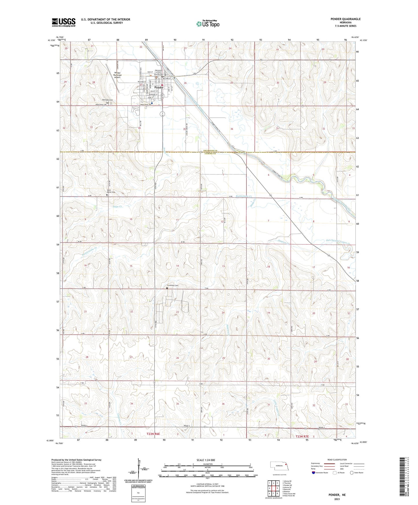
2021 topographic map quadrangle Pender in the state of Nebraska. Scale: 1:24000. Based on the newly updated USGS 7.5' US Topo map series, this map is in the following counties: Cuming, Thurston. The map contains contour data, water features, and other items you are used to seeing on USGS maps, but also has updated roads and other features. This is the next generation of topographic maps. Printed on high-quality waterproof paper with UV fade-resistant inks.
Quads adjacent to this one:
West: Altona SE
Northwest: Altona NE
North: Thurston
Northeast: Pender NE
East: Bancroft
Southeast: West Point NE
South: West Point NW
Southwest: Beemer
This map covers the same area as the classic USGS quad with code o42096a6.
Contains the following named places: Assembly of God Cornerstone Church, Covenant Cemetery, Evangelical Covenant Church, Heritage Museum of Thurston County, House Memorial Public Library, Jeppson Creek, Lampe Landing Field, Logan Creek Dredge, Midwest Ear Nose and Throat Clinic, Pender, Pender Care Center, Pender Community Hospital, Pender Grain Incorporated Elevator, Pender Medical Clinic, Pender Municipal Airport, Pender Park, Pender Post Office, Pender Public Schools, Pender Volunteer Fire Department, Rattlesnake Creek, Rose Hill Cemetery, Saint John the Baptist Catholic Church, Saint Johns Church, Saint Marks Cemetery, Saint Marks Lutheran Church, School Number 21, School Number 37, School Number 5, School Number 53, School Number 62, School Number 80, Stage Creek, Thurston County Courthouse, Thurston County Sheriff's Office, Township of Cleveland, United Church of Pender, Village of Pender, Village of Pender Campground, ZIP Code: 68047