MyTopo
Black Lake Nebraska US Topo Map
Couldn't load pickup availability
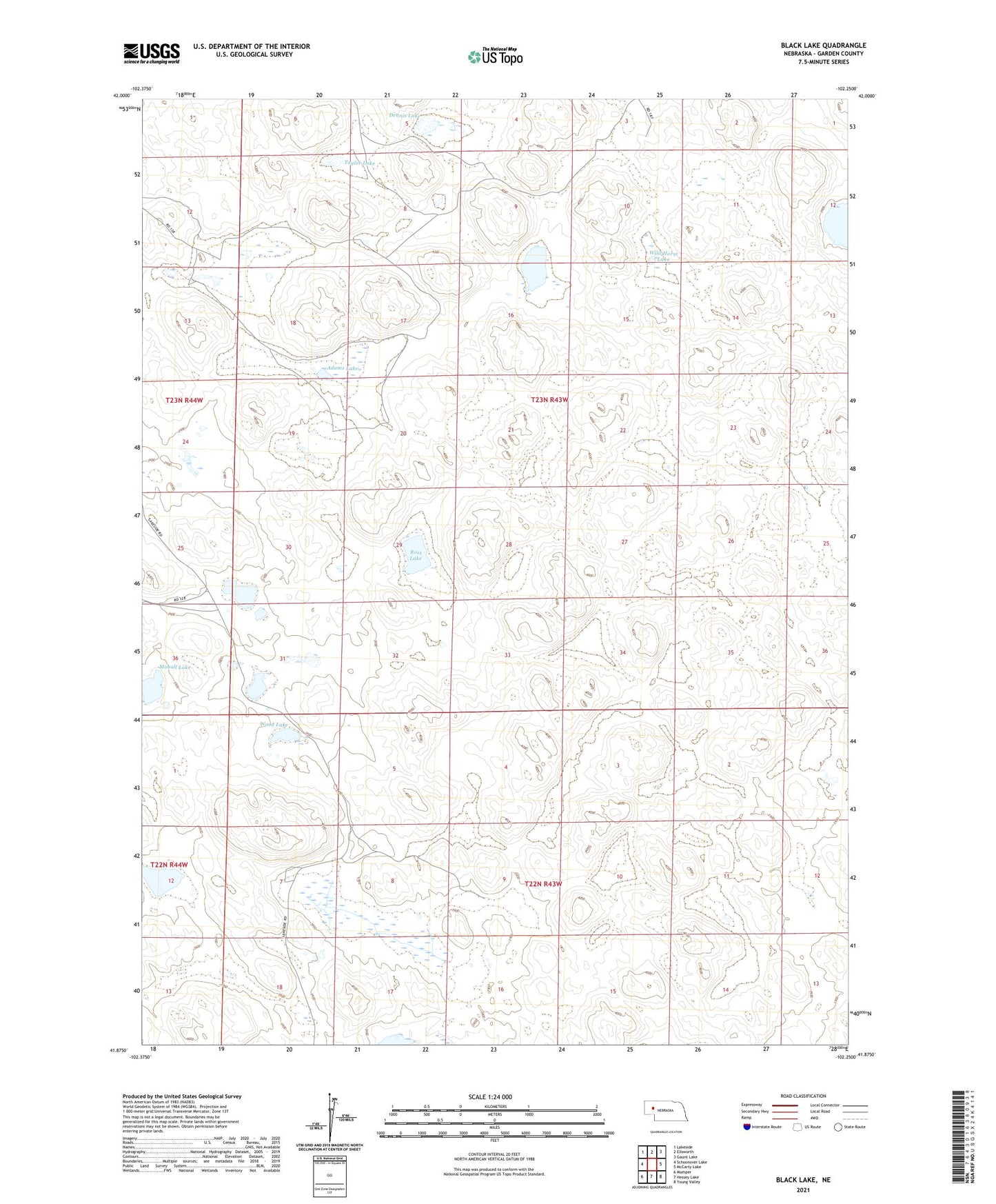
2021 topographic map quadrangle Black Lake in the state of Nebraska. Scale: 1:24000. Based on the newly updated USGS 7.5' US Topo map series, this map is in the following counties: Garden. The map contains contour data, water features, and other items you are used to seeing on USGS maps, but also has updated roads and other features. This is the next generation of topographic maps. Printed on high-quality waterproof paper with UV fade-resistant inks.
Quads adjacent to this one:
West: Schoonover Lake
Northwest: Lakeside
North: Ellsworth
Northeast: Gaunt Lake
East: McCarty Lake
Southeast: Young Valley
South: Hessey Lake
Southwest: Mumper
Contains the following named places: Adams Lake, Adams Ranch, Black Lake, Black Ranch, Dennis Lake, Half Circle Ranch, Hills Ranch, McCullock Ranch, Mohall Lake, Rockford Lake, Ross Lake, School Number 78, Taylor Lake, Townsend Lake, Wild Horse Lake, Wood Lake