MyTopo
Brownlee Nebraska US Topo Map
Couldn't load pickup availability
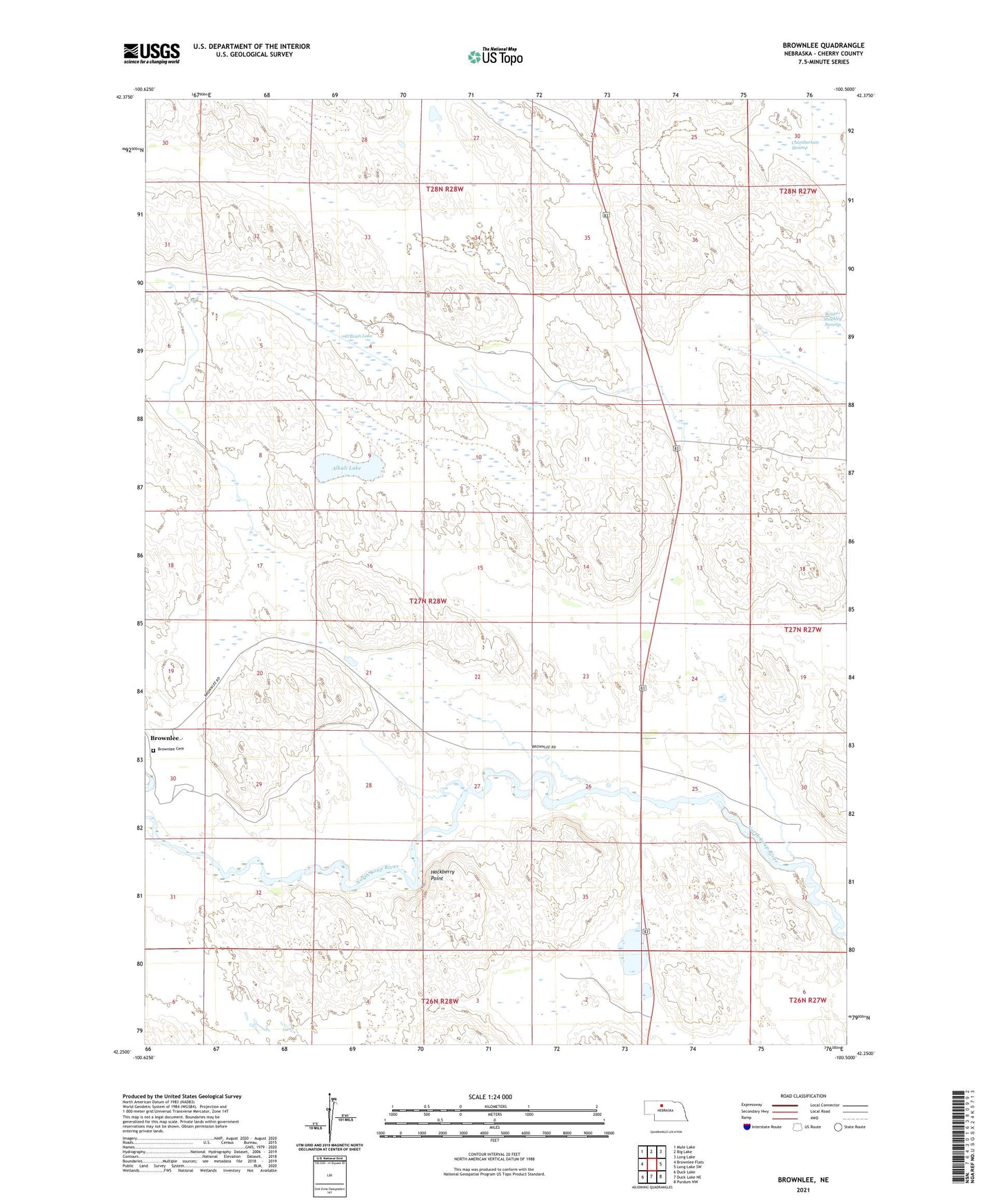
2021 topographic map quadrangle Brownlee in the state of Nebraska. Scale: 1:24000. Based on the newly updated USGS 7.5' US Topo map series, this map is in the following counties: Cherry. The map contains contour data, water features, and other items you are used to seeing on USGS maps, but also has updated roads and other features. This is the next generation of topographic maps. Printed on high-quality waterproof paper with UV fade-resistant inks.
Quads adjacent to this one:
West: Brownlee Flats
Northwest: Mule Lake
North: Big Lake
Northeast: Long Lake
East: Long Lake SW
Southeast: Purdum NW
South: Duck Lake NE
Southwest: Duck Lake
This map covers the same area as the classic USGS quad with code o42100c5.
Contains the following named places: Alkali Lake, Brownlee Census Designated Place, Brownlee Public School, Chamberlain Swamp, Goose Creek Public School, H Reiser Ranch, Hackberry Point, Loup Election Precinct, Miles Ranch, O'Brien Lake, Reiser-Shockley Swamp, Richardson Ranch, Saint Joan of Arc Church, School Number 37, Spencer Ranch, T Reiser Ranch, W Reiser Ranch