MyTopo
Brownlee Flats Nebraska US Topo Map
Couldn't load pickup availability
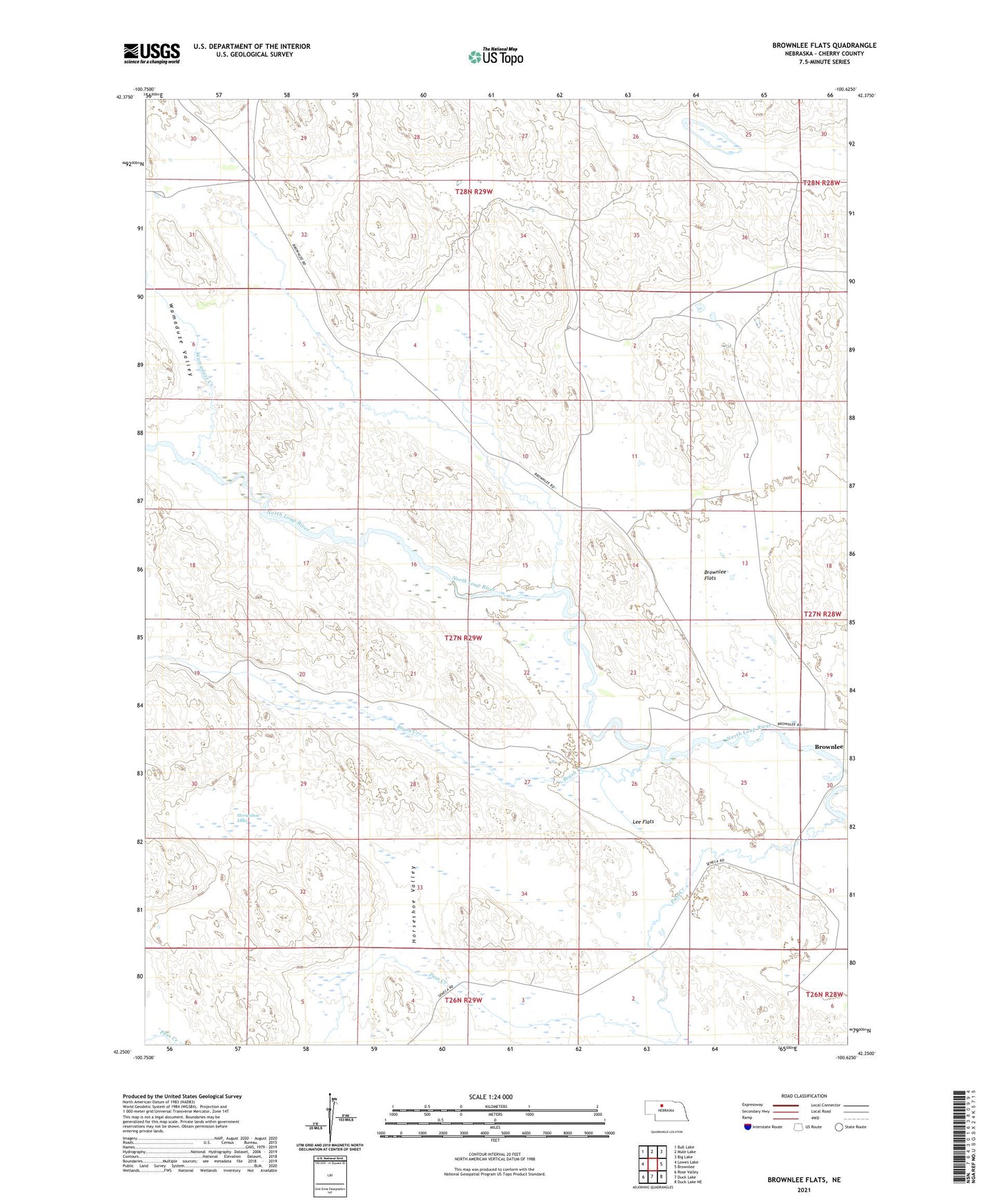
2021 topographic map quadrangle Brownlee Flats in the state of Nebraska. Scale: 1:24000. Based on the newly updated USGS 7.5' US Topo map series, this map is in the following counties: Cherry. The map contains contour data, water features, and other items you are used to seeing on USGS maps, but also has updated roads and other features. This is the next generation of topographic maps. Printed on high-quality waterproof paper with UV fade-resistant inks.
Quads adjacent to this one:
West: Lowes Lake
Northwest: Bull Lake
North: Mule Lake
Northeast: Big Lake
East: Brownlee
Southeast: Duck Lake NE
South: Duck Lake
Southwest: Rose Valley
This map covers the same area as the classic USGS quad with code o42100c6.
Contains the following named places: Box T Ranch, Brownlee, Brownlee Flats, Brush Creek, C Pound Ranch, C Reiser Ranch, D Hanna Ranch, F Hanna Ranch, Horseshoe Lake, Horseshoe Valley, Lee Flats, M Lee Ranch, Maahs Ranch, Pass Creek, School Number 108, School Number 179, Shadbolt Ranch, Shanley Ranch, Stichka Ranch, Wamaduze Creek, Wamaduze Valley