MyTopo
Brule SE Nebraska US Topo Map
Couldn't load pickup availability
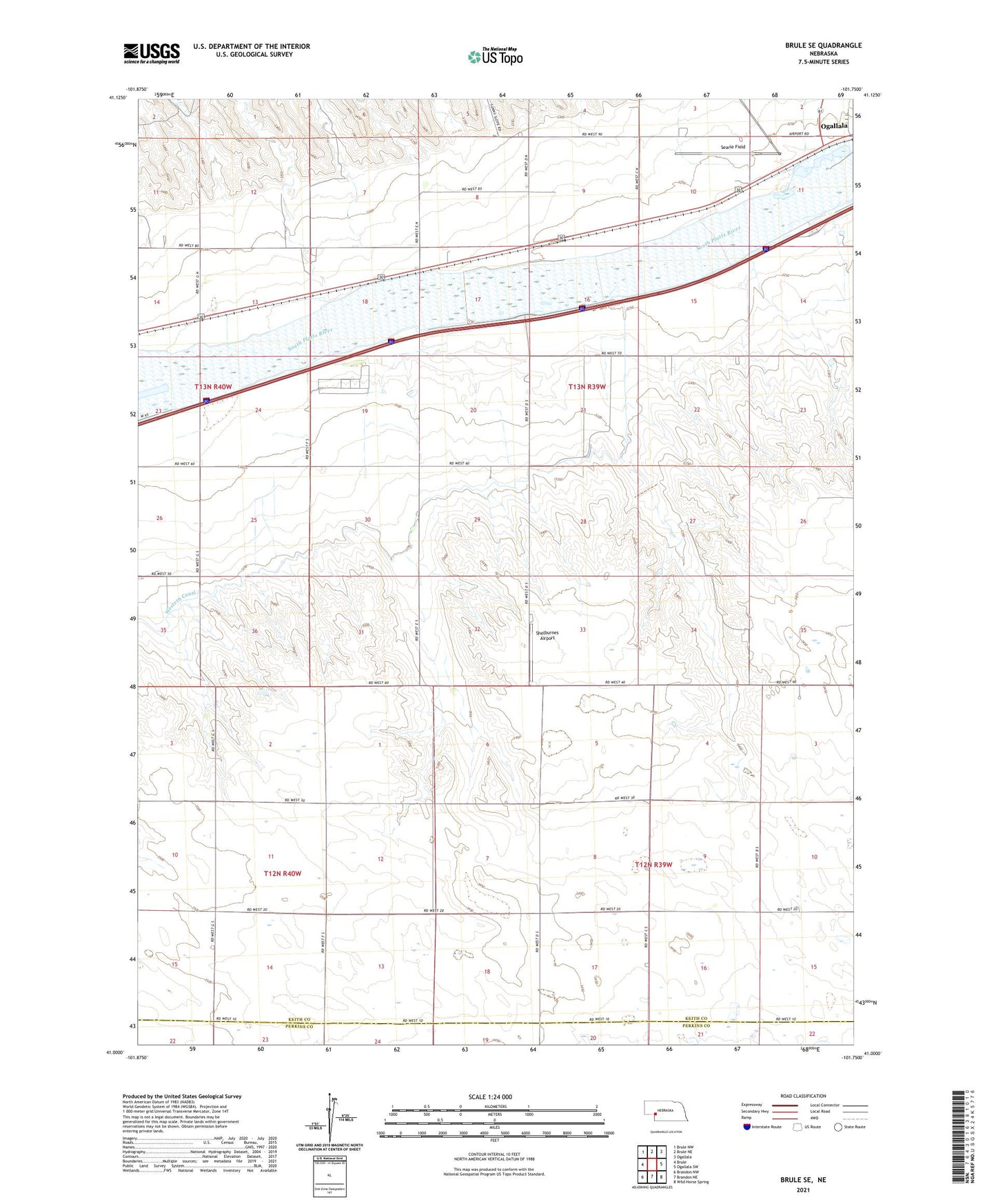
2021 topographic map quadrangle Brule SE in the state of Nebraska. Scale: 1:24000. Based on the newly updated USGS 7.5' US Topo map series, this map is in the following counties: Keith, Perkins. The map contains contour data, water features, and other items you are used to seeing on USGS maps, but also has updated roads and other features. This is the next generation of topographic maps. Printed on high-quality waterproof paper with UV fade-resistant inks.
Quads adjacent to this one:
West: Brule
Northwest: Brule NW
North: Brule NE
Northeast: Ogallala
East: Ogallala SW
Southeast: Wild Horse Spring
South: Brandon NE
Southwest: Brandon NW
This map covers the same area as the classic USGS quad with code o41101a7.
Contains the following named places: Chase Canyon, Detention Dam 1, Ogallala Eastbound Travel Information Center, Ogallala Rest Area - Eastbound, School Number 14, School Number 48, School Number 5, School Number 62, School Number 9, Searle Field, Shelburnes Airport, Western Irrigation District Number 1 Dam, Western Irrigation District Reservoir