MyTopo
Ogallala Nebraska US Topo Map
Couldn't load pickup availability
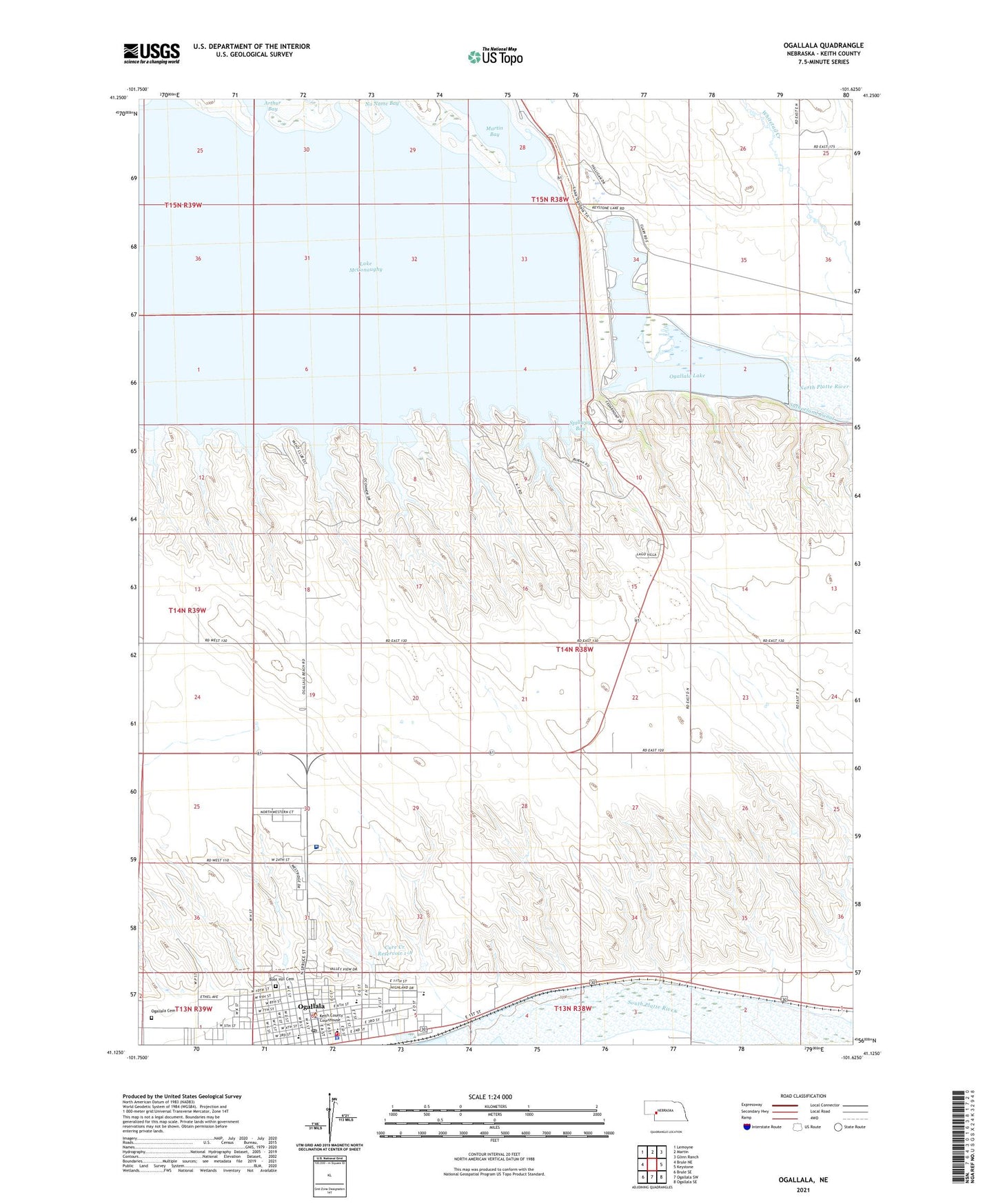
2021 topographic map quadrangle Ogallala in the state of Nebraska. Scale: 1:24000. Based on the newly updated USGS 7.5' US Topo map series, this map is in the following counties: Keith. The map contains contour data, water features, and other items you are used to seeing on USGS maps, but also has updated roads and other features. This is the next generation of topographic maps. Printed on high-quality waterproof paper with UV fade-resistant inks.
Quads adjacent to this one:
West: Brule NE
Northwest: Lemoyne
North: Martin
Northeast: Glinn Ranch
East: Keystone
Southeast: Ogallala SE
South: Ogallala SW
Southwest: Brule SE
This map covers the same area as the classic USGS quad with code o41101b6.
Contains the following named places: Anchor Baptist Church, Arthur Bay, Berean Fundamental Church, Boot Hill Cemetery, Boot Hill Historical Marker, Caddi Shack Campground, Cedar Point Camp, Church of Christ, Church of God, City of Ogallala, Colister Park, Cowboy Capital Historical Marker, Cozy Country Cove, Cure Creek Dam 1-A, Cure Creek Reservoir 1-A, Ear Nose Throat and Sinus Clinic, Faith Evangelical Free Church, Family Medical Center, First Baptist Church, First Congregational United Church of Christ, Glines/Nye Park, Goodall City Library, Goodall Recreation Center, Humphreys Pond, Indian Hills Manor, Jehovahs Witnesses Kingdom Hall, Keith County, Keith County Courthouse, Keith County Fairgrounds, Keith County Sheriff's Office, Keystone Diversion Dam, Keystone Pond-Lake Ogallala, Kingsley Dam, Kingsley Dam Eagle Viewing Facility, Kingsley Lodge Campground, KMCX-FM (Ogallala), KOGA-AM (Ogallala), L and L Mobile Home Park, Lake Ogallala State Recreation Area, Lake Ogallala Trail, Legion Field, Lighthouse Baptist Church, Mansion on the Hill, Martin Bay, Nebraska National Trails Museum, North Park, North Platte Foot Clinic, Ogallala, Ogallala Beach Campground, Ogallala Cemetery, Ogallala Community Hospital, Ogallala Dam East, Ogallala Dam West, Ogallala High School, Ogallala Lake, Ogallala Medical Group, Ogallala Middle School, Ogallala Police Department, Ogallala Post Office, Ogallala Trail, Ogallala Volunteer Fire Department, Pioneer Park, Platte Valley Diversion-1 Dam, Prairie Mobile Clinic, Prairie View Elementary School, Progress School, Radiant Life Assembly of God Church, Saint Lukes Catholic Church, Saint Lukes School, Saint Pauls Episcopal Church, Saint Pauls Lutheran Church, Saint Pauls School, School Number 18, Searle Park, Seventh Day Adventist Church, Spillway Bay, Spillway Bay Campground, Spillway Park, United Methodist Church, United Pentecostal Church, Victory Baptist Church, West 5th School, West Park, Williams Park