MyTopo
Butte Nebraska US Topo Map
Couldn't load pickup availability
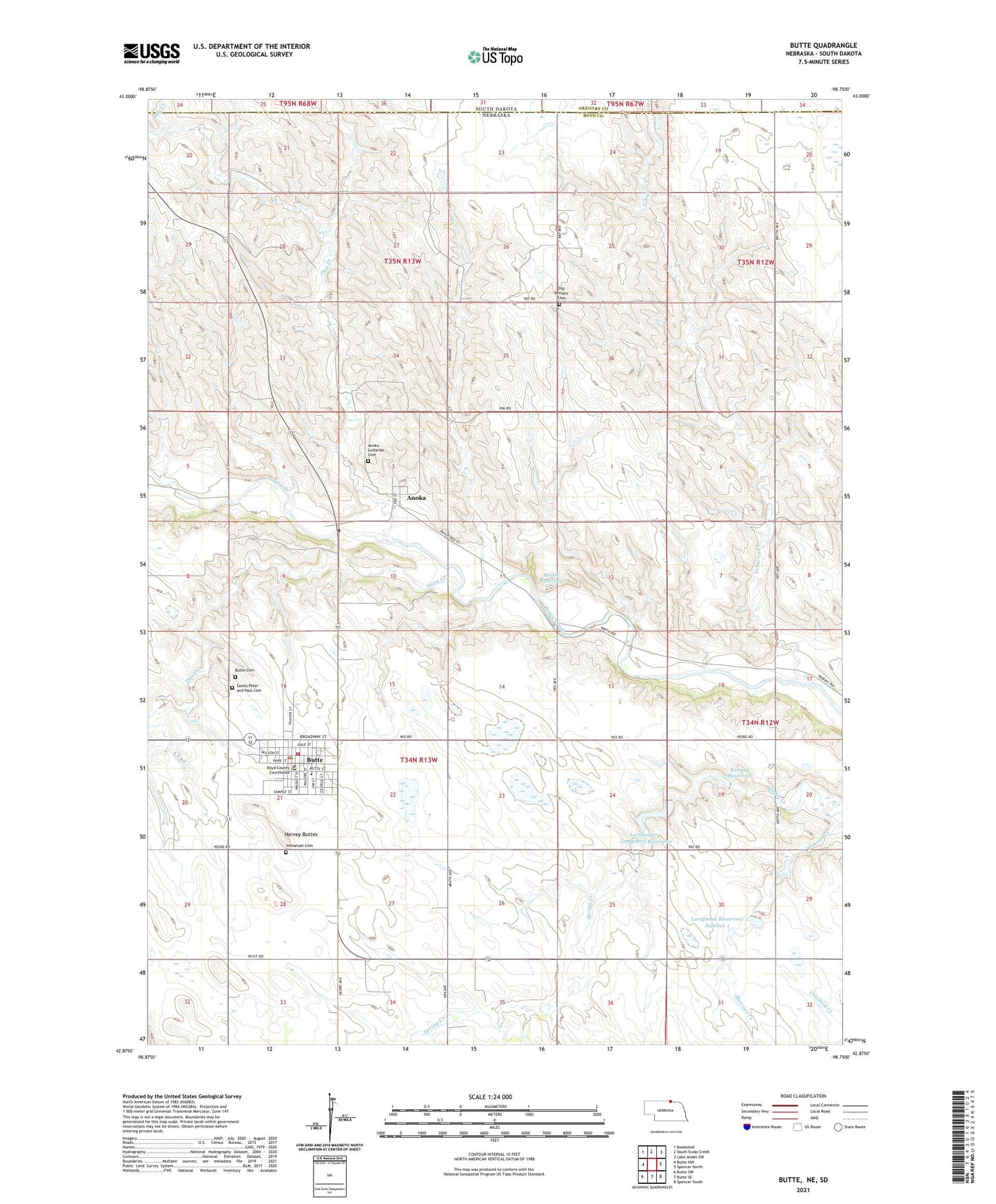
2021 topographic map quadrangle Butte in the state of Nebraska. Scale: 1:24000. Based on the newly updated USGS 7.5' US Topo map series, this map is in the following counties: Boyd, Gregory. The map contains contour data, water features, and other items you are used to seeing on USGS maps, but also has updated roads and other features. This is the next generation of topographic maps. Printed on high-quality waterproof paper with UV fade-resistant inks.
Quads adjacent to this one:
West: Butte NW
Northwest: Bonesteel
North: South Scalp Creek
Northeast: Lake Andes SW
East: Spencer North
Southeast: Spencer South
South: Butte SE
Southwest: Butte SW
Contains the following named places: Anoka, Anoka Lutheran Cemetery, Anoka Post Office, Boyd County, Boyd County Ambulance Service, Boyd County Courthouse, Boyd County Sheriff's Office, Butte, Butte Cemetery, Butte City Park, Butte Fire Department, Butte Golf Course, Butte Medical Center, Butte Medical Clinic, Butte Nursing Home, Butte Post Office, Butte Public Schools, Community Bible Church, Dizzy Creek, Dry Creek, Full Gospel Church, Harvey Buttes, Immanuel Cemetery, Lampman Dam Number 1, Lampman Reservoir Number 1, Lechtenberg-Lampman Dam, Lechtenberg-Lampman Reservoir, Old Settlers Cemetery, Reiman Dam, Reiman Reservoir, Reiser Dam, Reiser Reservoir, Saints Peter and Paul Catholic Church, Saints Peter and Paul Cemetery, Tobacco Creek, Township of Butte, Village of Anoka, Village of Butte, ZIP Code: 68722