MyTopo
Spencer South Nebraska US Topo Map
Couldn't load pickup availability
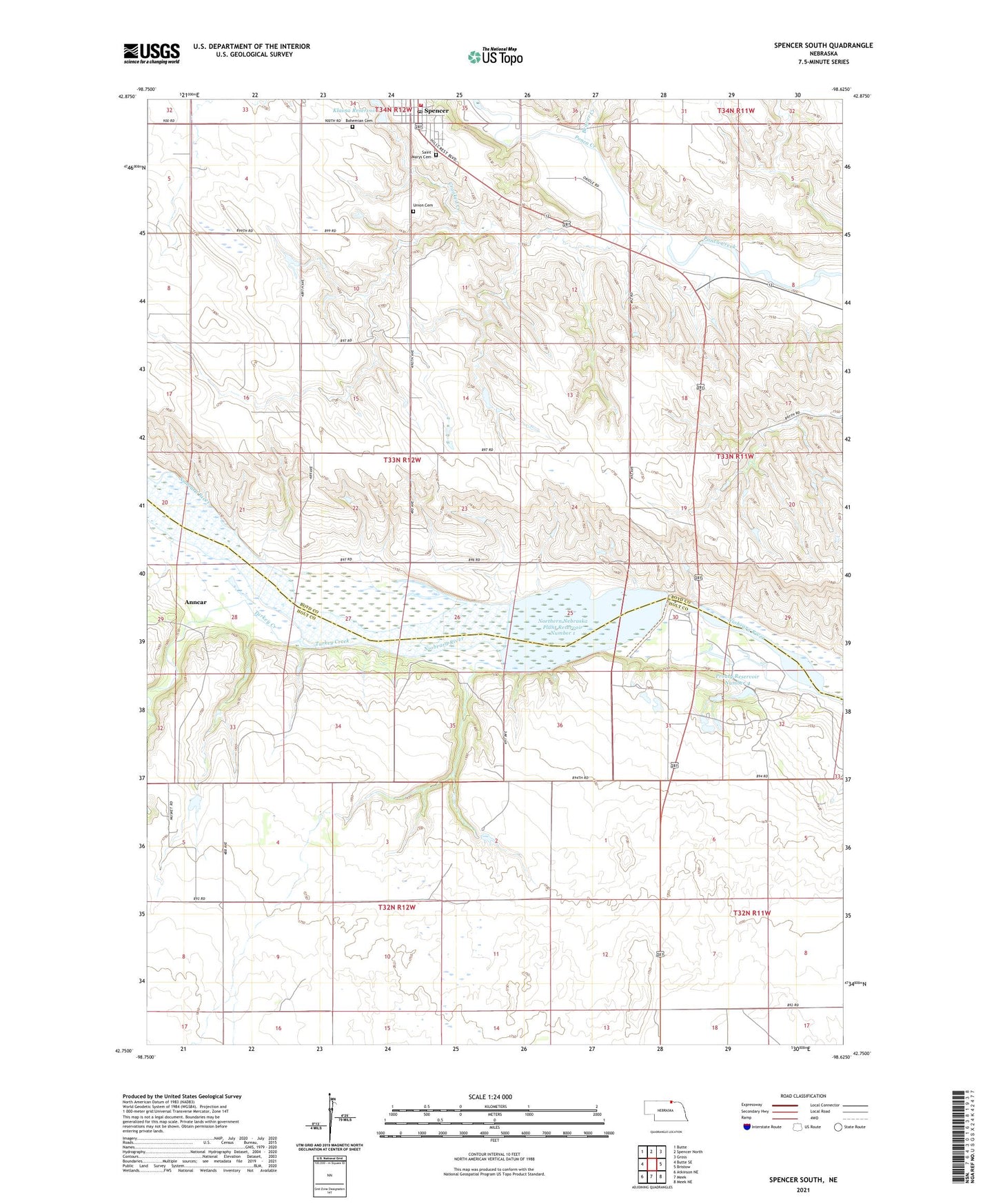
2021 topographic map quadrangle Spencer South in the state of Nebraska. Scale: 1:24000. Based on the newly updated USGS 7.5' US Topo map series, this map is in the following counties: Boyd, Holt. The map contains contour data, water features, and other items you are used to seeing on USGS maps, but also has updated roads and other features. This is the next generation of topographic maps. Printed on high-quality waterproof paper with UV fade-resistant inks.
Quads adjacent to this one:
West: Butte SE
Northwest: Butte
North: Spencer North
Northeast: Gross
East: Bristow
Southeast: Meek NE
South: Meek
Southwest: Atkinson NE
This map covers the same area as the classic USGS quad with code o42098g6.
Contains the following named places: Anncar, Anncar Post Office, Beaver Creek, Bohemian Cemetery, Crooked Creek, Immanuel Lutheran Church, Klasna Dam, Klasna Reservoir, Niobrara Valley Medical Clinic, Northern Nebraska Plant Reservoir Number 1, Our Saviours Lutheran Church, Prouty Dam Number 4, Prouty Reservoir Number 4, Saint Marys Catholic Church, Saint Marys Cemetery, School Number 14, School Number 142, School Number 6, Spencer, Spencer Dam, Spencer Medical Clinic, Spencer Park - Fairgrounds Campground, Spencer Police Department, Spencer Post Office, Spencer Township Library, Spencer Volunteer Fire Department, Spencer Volunteer Rescue Unit, Township of Coleman, Turkey Creek, Union Cemetery, United Methodist Church, Wesleyan Church, ZIP Code: 68777