MyTopo
Cedar Rapids Nebraska US Topo Map
Couldn't load pickup availability
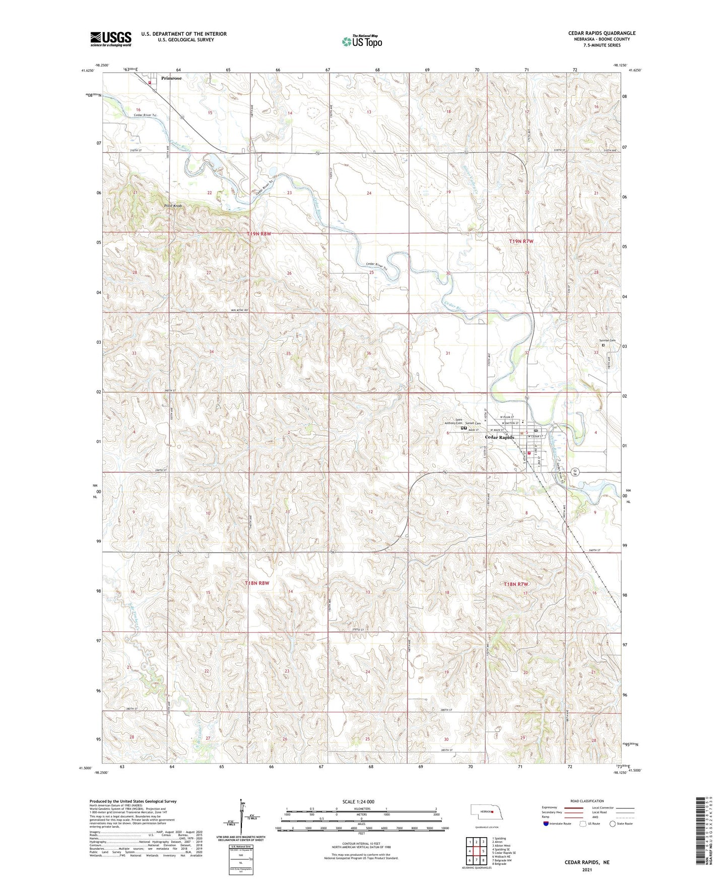
2021 topographic map quadrangle Cedar Rapids in the state of Nebraska. Scale: 1:24000. Based on the newly updated USGS 7.5' US Topo map series, this map is in the following counties: Boone. The map contains contour data, water features, and other items you are used to seeing on USGS maps, but also has updated roads and other features. This is the next generation of topographic maps. Printed on high-quality waterproof paper with UV fade-resistant inks.
Quads adjacent to this one:
West: Spalding SE
Northwest: Spalding
North: Akron
Northeast: Albion West
East: Cedar Rapids SE
Southeast: Belgrade
South: Belgrade NW
Southwest: Wolbach NE
Contains the following named places: Cedar Election Precinct, Cedar Rapids, Cedar Rapids City Park, Cedar Rapids Medical Clinic, Cedar Rapids Municipal Airport, Cedar Rapids Post Office, Cedar Rapids Public Library, Cedar Rapids Public Schools, Cedar Rapids Rescue Squad, Cedar Rapids Volunteer Fire Department, Cedar Valley Cooperative Company Elevator, Mels Landing Park Campground, Pilot Knob, Poverty Ridge Camp Ground, Primrose, Primrose Post Office, Primrose Public Library, Primrose Rural Fire District 5, Saint Anthony Catholic Church, Saint Anthony Cemetery, Saint Johns Lutheran Church, Saint Mary Catholic Church, School Number 14, School Number 48, Silver Valley Creek, Standard School, Sunrise Cemetery, Sunset Cemetery, United Methodist Church, Village of Cedar Rapids, Village of Primrose, ZIP Code: 68627