MyTopo
Belgrade NW Nebraska US Topo Map
Couldn't load pickup availability
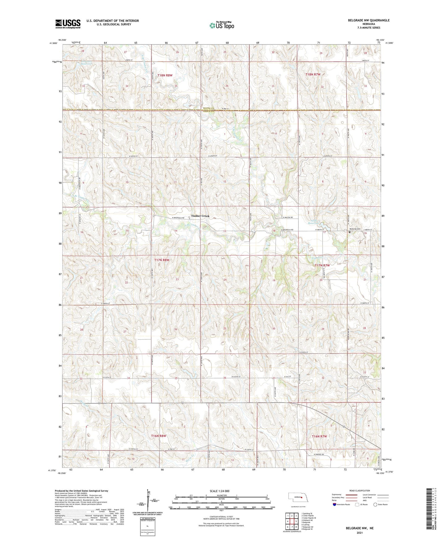
2021 topographic map quadrangle Belgrade NW in the state of Nebraska. Scale: 1:24000. Based on the newly updated USGS 7.5' US Topo map series, this map is in the following counties: Nance, Boone. The map contains contour data, water features, and other items you are used to seeing on USGS maps, but also has updated roads and other features. This is the next generation of topographic maps. Printed on high-quality waterproof paper with UV fade-resistant inks.
Quads adjacent to this one:
West: Wolbach NE
Northwest: Spalding SE
North: Cedar Rapids
Northeast: Cedar Rapids SE
East: Belgrade
Southeast: Belgrade SE
South: Belgrade SW
Southwest: Cushing
This map covers the same area as the classic USGS quad with code o41098d2.
Contains the following named places: Banner School, Bruna School, Clay Ridge School, Meadowlark Hill School, Mount Zion School, North Branch Timber Creek, North Star School, Peace Lutheran Church, Pleasant View School, Redwing Cemetery, Redwing School, Ridgewood School, Robinson Dam, Robinson Reservoir, School Number 29, School Number 46, Scott Dam, Scott Reservoir, South Branch Timber Creek, Timber Creek, Township of Cedar, Township of South Branch, ZIP Code: 68623