MyTopo
Belgrade Nebraska US Topo Map
Couldn't load pickup availability
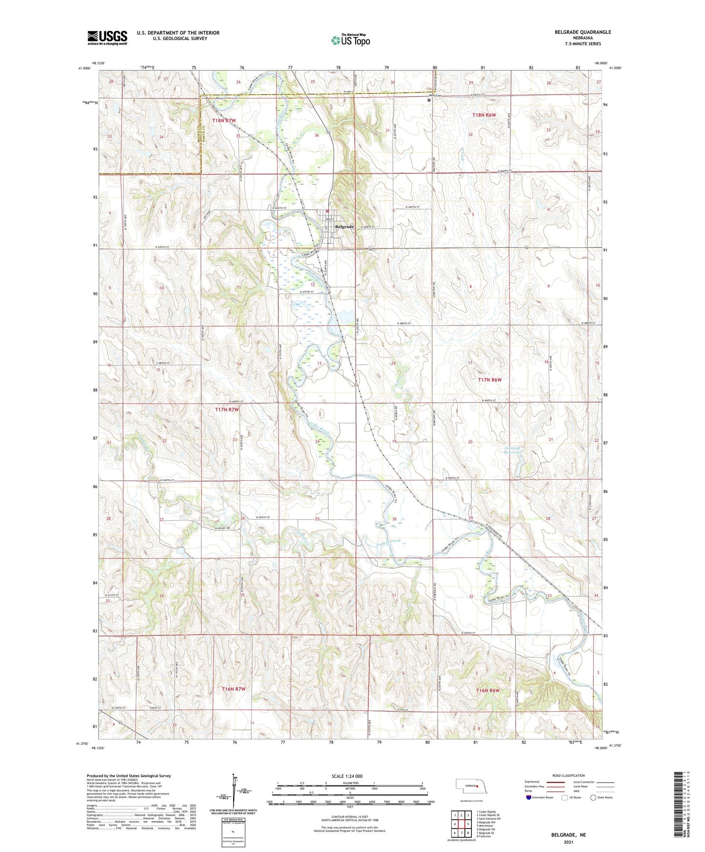
2021 topographic map quadrangle Belgrade in the state of Nebraska. Scale: 1:24000. Based on the newly updated USGS 7.5' US Topo map series, this map is in the following counties: Nance, Boone. The map contains contour data, water features, and other items you are used to seeing on USGS maps, but also has updated roads and other features. This is the next generation of topographic maps. Printed on high-quality waterproof paper with UV fade-resistant inks.
Quads adjacent to this one:
West: Belgrade NW
Northwest: Cedar Rapids
North: Cedar Rapids SE
Northeast: Saint Edward SW
East: Merchiston
Southeast: Fullerton
South: Belgrade SE
Southwest: Belgrade SW
This map covers the same area as the classic USGS quad with code o41098d1.
Contains the following named places: Ash Creek, Belgrade, Belgrade Grain Company Elevator, Belgrade Post Office - CPO, Belgrade Public School, Belgrade Volunteer Fire Department, Fairview School, Gdowski Dam, Gdowski Reservoir, Hellbusch Dam, Main Cemetery, Sandy Ridge School, School Number 7, Standard School, Sunnyglade School, Timber Creek, Township of Cedar, Township of Plum Creek, Township of Timber Creek, Village of Belgrade, Woodlawn School