MyTopo
Silver Creek Nebraska US Topo Map
Couldn't load pickup availability
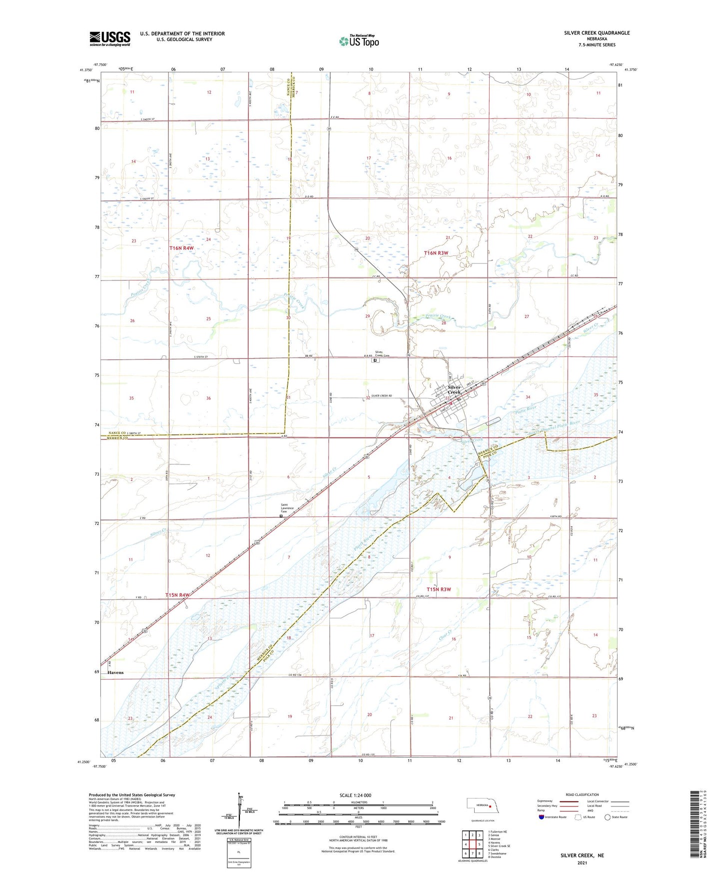
2021 topographic map quadrangle Silver Creek in the state of Nebraska. Scale: 1:24000. Based on the newly updated USGS 7.5' US Topo map series, this map is in the following counties: Merrick, Polk, Nance. The map contains contour data, water features, and other items you are used to seeing on USGS maps, but also has updated roads and other features. This is the next generation of topographic maps. Printed on high-quality waterproof paper with UV fade-resistant inks.
Quads adjacent to this one:
West: Havens
Northwest: Fullerton NE
North: Genoa
Northeast: Monroe
East: Silver Creek SE
Southeast: Osceola
South: Swedehome
Southwest: Clarks
This map covers the same area as the classic USGS quad with code o41097c6.
Contains the following named places: Annie Jeffrey Family Medicine, Fishers Cove Campground, Havens, Husker Co-op Elevator, Saint Lawrence Catholic Church, Saint Lawrence Cemetery, Schafer, School Number 40, Silver Creek, Silver Creek Cemetery, Silver Creek Post Office, Silver Creek Township Library, Silver Creek Volunteer Fire Department, Sunny Hollow State Wildlife Management Area, Township of Silver Creek, United Methodist Church, Village of Silver Creek, ZIP Code: 68663