MyTopo
Lindsay Nebraska US Topo Map
Couldn't load pickup availability
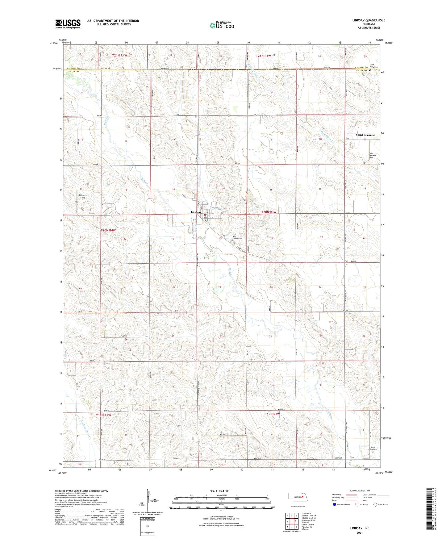
2021 topographic map quadrangle Lindsay in the state of Nebraska. Scale: 1:24000. Based on the newly updated USGS 7.5' US Topo map series, this map is in the following counties: Platte, Madison. The map contains contour data, water features, and other items you are used to seeing on USGS maps, but also has updated roads and other features. This is the next generation of topographic maps. Printed on high-quality waterproof paper with UV fade-resistant inks.
Quads adjacent to this one:
West: Newman Grove
Northwest: Closter SE
North: Battle Creek SW
Northeast: Battle Creek SE
East: Cornlea
Southeast: Tarnov
South: Lindsay SW
Southwest: Saint Edward
This map covers the same area as the classic USGS quad with code o41097f6.
Contains the following named places: Borg Dairy Farm, Farmers Co-op Association Elevator, Holy Family Cemetery, Holy Family Church, Holy Family Grade School, Holy Family High School, Johnston Field, Lindsay, Lindsay Post Office, Lindsay Public School, Lindsay Volunteer Fire and Rescue Service, Looking Glass School, Saint Bernard, Saint Bernard Catholic Church, Saint Bernard Cemetery, Saint Bernard Post Office, Saint Johns Cemetery, Saint Pauls Cemetery, School Number 18, School Number 64, Township of Saint Bernard, Village of Lindsay, ZIP Code: 68644