MyTopo
Coffee Mill Butte SE Nebraska US Topo Map
Couldn't load pickup availability
Also explore the Coffee Mill Butte SE Forest Service Topo of this same quad for updated USFS data
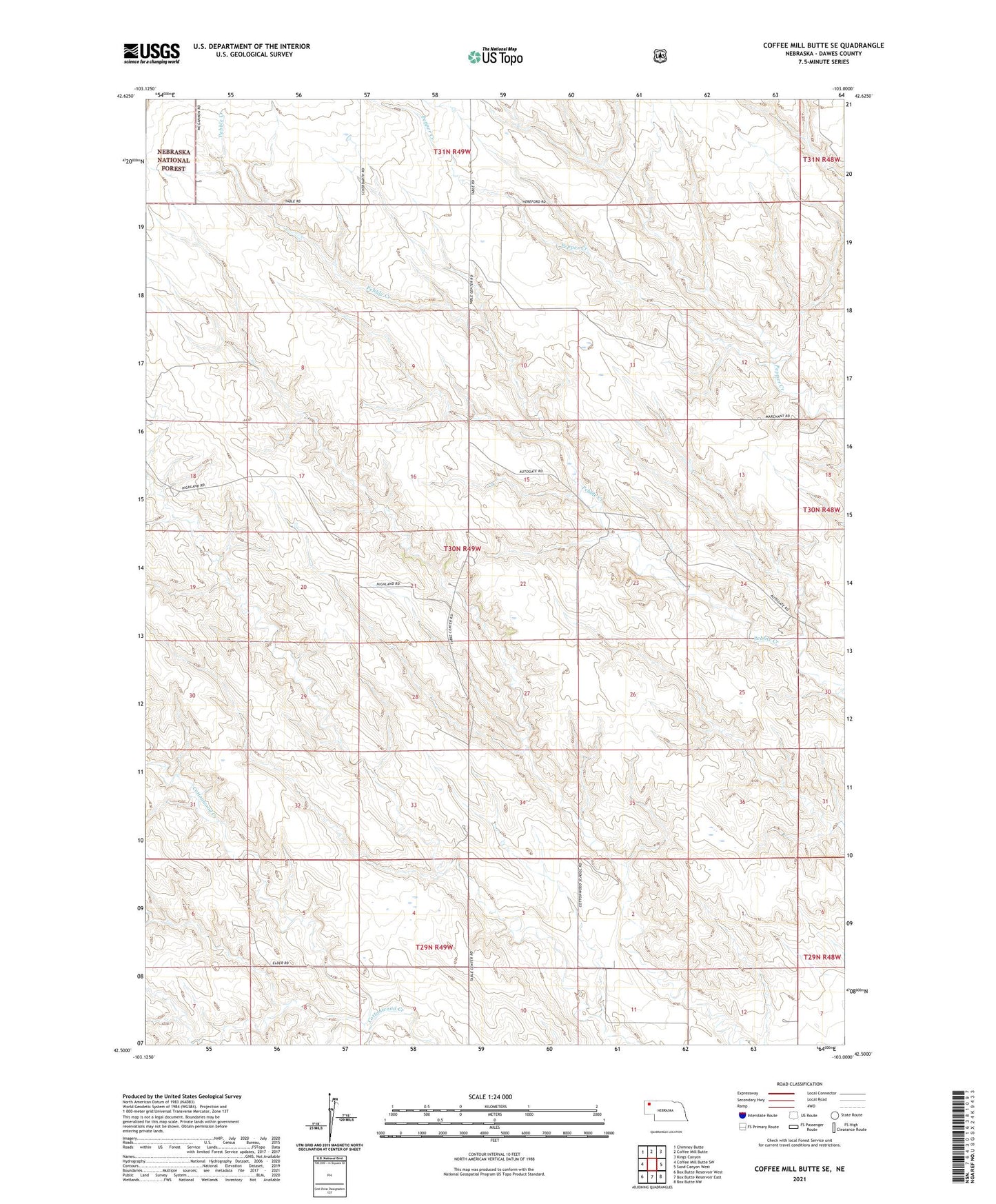
2021 topographic map quadrangle Coffee Mill Butte SE in the state of Nebraska. Scale: 1:24000. Based on the newly updated USGS 7.5' US Topo map series, this map is in the following counties: Dawes. The map contains contour data, water features, and other items you are used to seeing on USGS maps, but also has updated roads and other features. This is the next generation of topographic maps. Printed on high-quality waterproof paper with UV fade-resistant inks.
Quads adjacent to this one:
West: Coffee Mill Butte SW
Northwest: Chimney Butte
North: Coffee Mill Butte
Northeast: Kings Canyon
East: Sand Canyon West
Southeast: Box Butte NW
South: Box Butte Reservoir East
Southwest: Box Butte Reservoir West
This map covers the same area as the classic USGS quad with code o42103e1.
Contains the following named places: Election Precinct 07, Table Center School