MyTopo
Coffee Mill Butte Nebraska US Topo Map
Couldn't load pickup availability
Also explore the Coffee Mill Butte Forest Service Topo of this same quad for updated USFS data
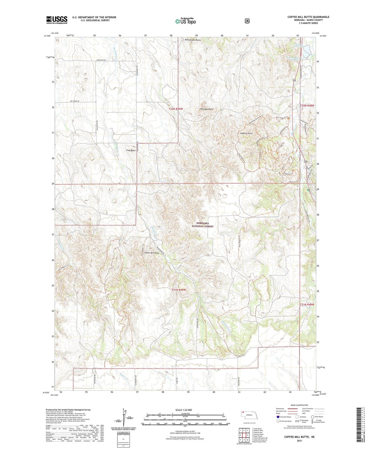
2021 topographic map quadrangle Coffee Mill Butte in the state of Nebraska. Scale: 1:24000. Based on the newly updated USGS 7.5' US Topo map series, this map is in the following counties: Dawes. The map contains contour data, water features, and other items you are used to seeing on USGS maps, but also has updated roads and other features. This is the next generation of topographic maps. Printed on high-quality waterproof paper with UV fade-resistant inks.
Quads adjacent to this one:
West: Chimney Butte
Northwest: Trunk Butte
North: Chadron West
Northeast: Chadron East
East: Kings Canyon
Southeast: Sand Canyon West
South: Coffee Mill Butte SE
Southwest: Coffee Mill Butte SW
This map covers the same area as the classic USGS quad with code o42103f1.
Contains the following named places: Camp Norwesca, Chadron Camping Area, Chadron Dam Number 2, Chadron Reservoir, Chadron Reservoir Number 2, Chadron State Park, Chadron State Park Historical Marker, Chadron State Park Trailhead, Chadron Trails, Coffee Mill Butte, Coffee Mill Trailhead, Flag Butte, Flag Butte School, Flannigan Butte, KQSK-FM (Chadron), Lookout Point, Open Door Church, Pine Ridge National Recreation Area, Pine Ridge Trail, Rattlesnake Butte, Red Cloud Campground, Red Cloud Picnic Area, Strong Canyon