MyTopo
Coleridge Nebraska US Topo Map
Couldn't load pickup availability
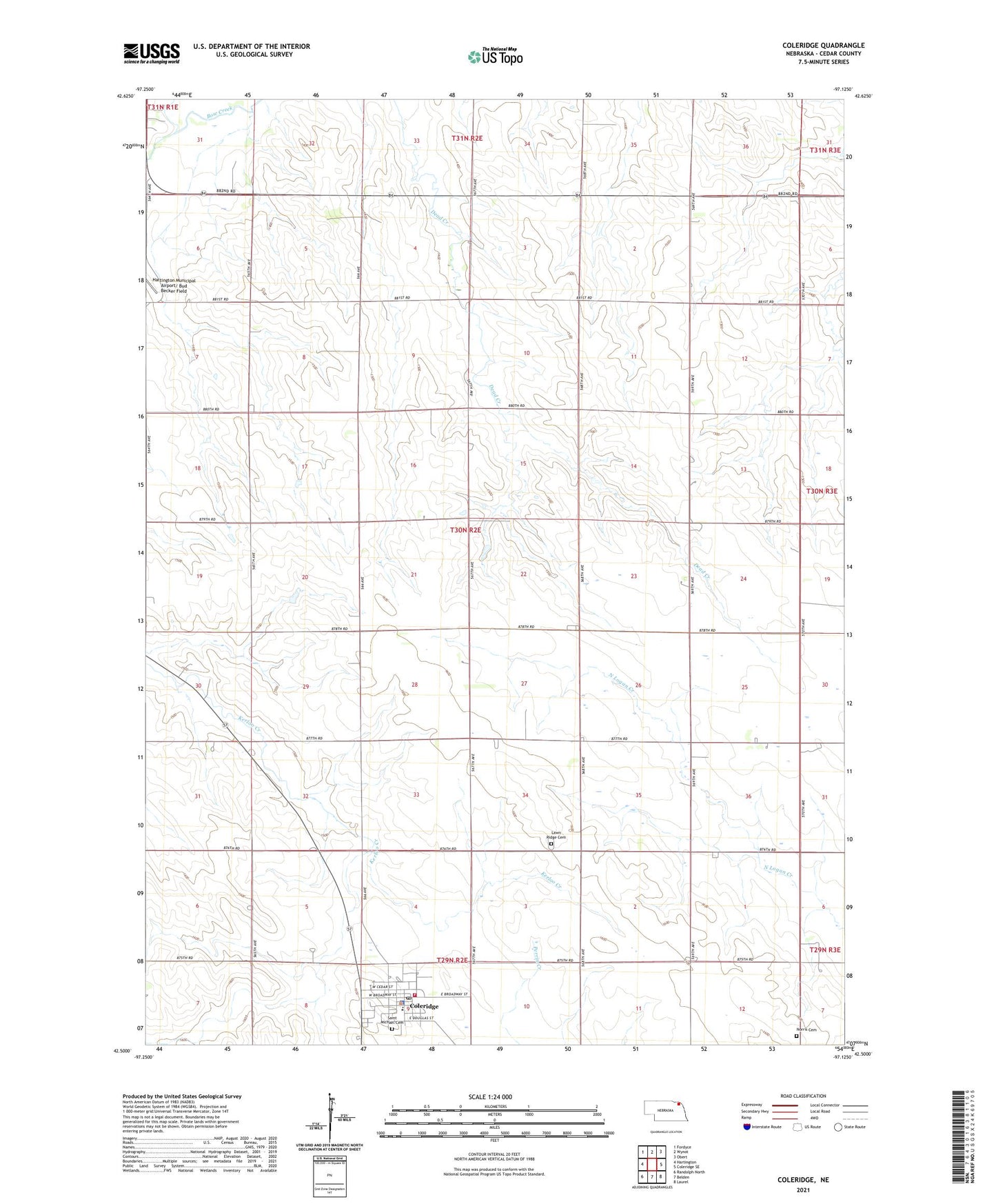
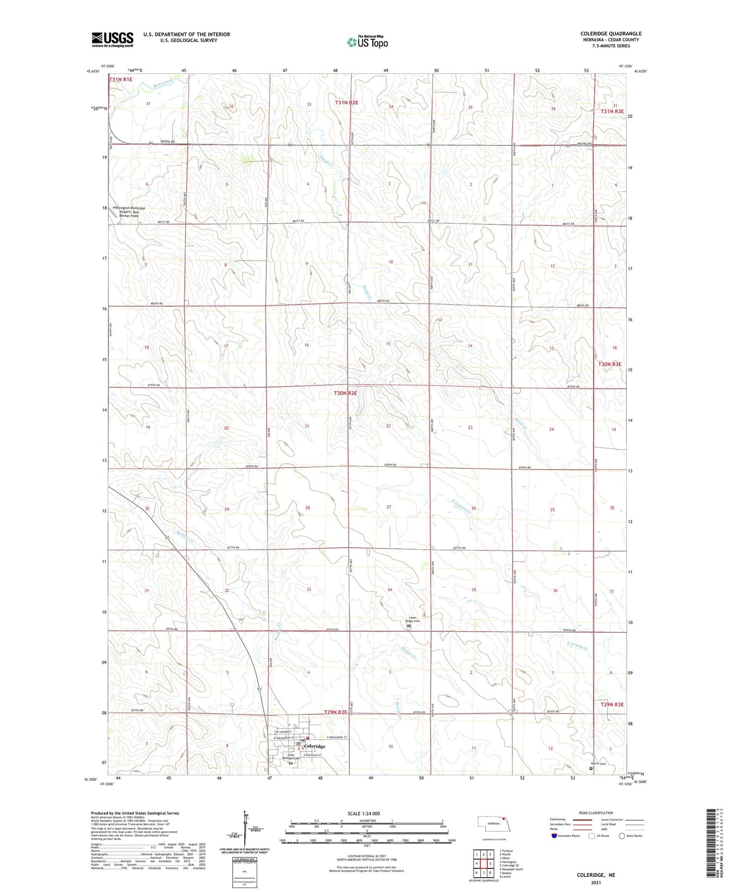
2021 topographic map quadrangle Coleridge in the state of Nebraska. Scale: 1:24000. Based on the newly updated USGS 7.5' US Topo map series, this map is in the following counties: Cedar. The map contains contour data, water features, and other items you are used to seeing on USGS maps, but also has updated roads and other features. This is the next generation of topographic maps. Printed on high-quality waterproof paper with UV fade-resistant inks.
Quads adjacent to this one:
West: Hartington
Northwest: Fordyce
North: Wynot
Northeast: Obert
East: Coleridge SE
Southeast: Laurel
South: Belden
Southwest: Randolph North
Contains the following named places: Coleridge, Coleridge Ambulance Service, Coleridge Community School, Coleridge Elevator, Coleridge Medical Clinic, Coleridge Police Department, Coleridge Post Office, Coleridge Village Park, Coleridge Village Park Campground, Coleridge Volunteer Fire Department, Congregational Church, Election Precinct 13, Immanuel Lutheran Church, Lawn Ridge Cemetery, New Life Assembly Church, Norris Cemetery, Norwegian Bow Creek, Park View Haven Nursing Home, Precinct Sixteen, Precinct Thirteen, Saint Michael Cemetery, Saint Michaels Catholic Church, Village of Coleridge, ZIP Code: 68727