MyTopo
Wynot Nebraska US Topo Map
Couldn't load pickup availability
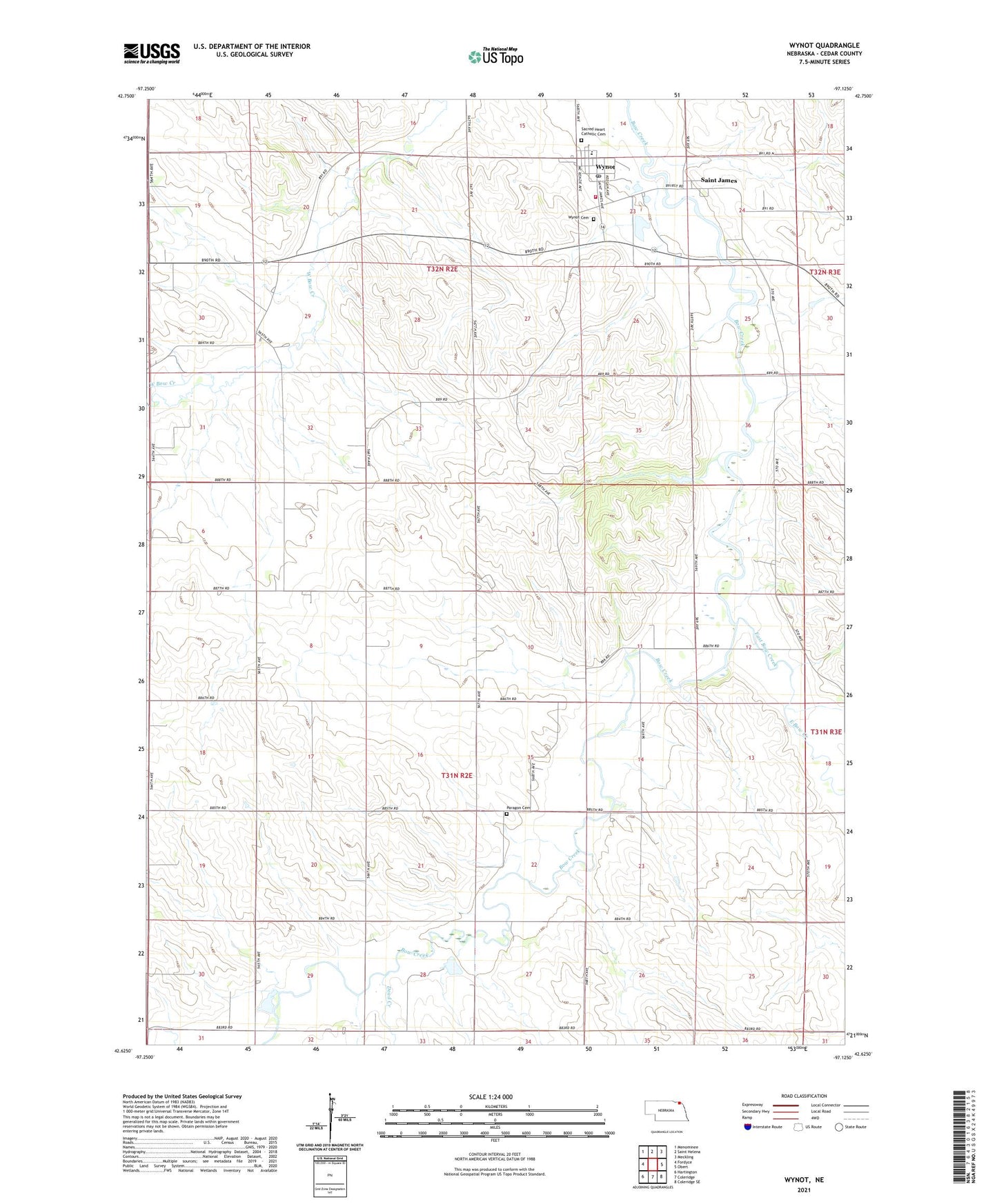
2021 topographic map quadrangle Wynot in the state of Nebraska. Scale: 1:24000. Based on the newly updated USGS 7.5' US Topo map series, this map is in the following counties: Cedar. The map contains contour data, water features, and other items you are used to seeing on USGS maps, but also has updated roads and other features. This is the next generation of topographic maps. Printed on high-quality waterproof paper with UV fade-resistant inks.
Quads adjacent to this one:
West: Fordyce
Northwest: Menominee
North: Saint Helena
Northeast: Meckling
East: Obert
Southeast: Coleridge SE
South: Coleridge
Southwest: Hartington
This map covers the same area as the classic USGS quad with code o42097f2.
Contains the following named places: Bow Valley, Bow Valley Post Office, Cedar County Fairground, Dead Creek, East Bow Creek, Election Precinct 5, Election Precinct 8, Paragon Cemetery, Precinct Eight, Precinct Five, Saint Jamed Post Office, Saint James, Village of Wynot, Wynot, Wynot Ambulance Service, Wynot Cemetery, Wynot City Park, Wynot Fire Department, Wynot Post Office, Wynot Public Schools