MyTopo
Hartington Nebraska US Topo Map
Couldn't load pickup availability
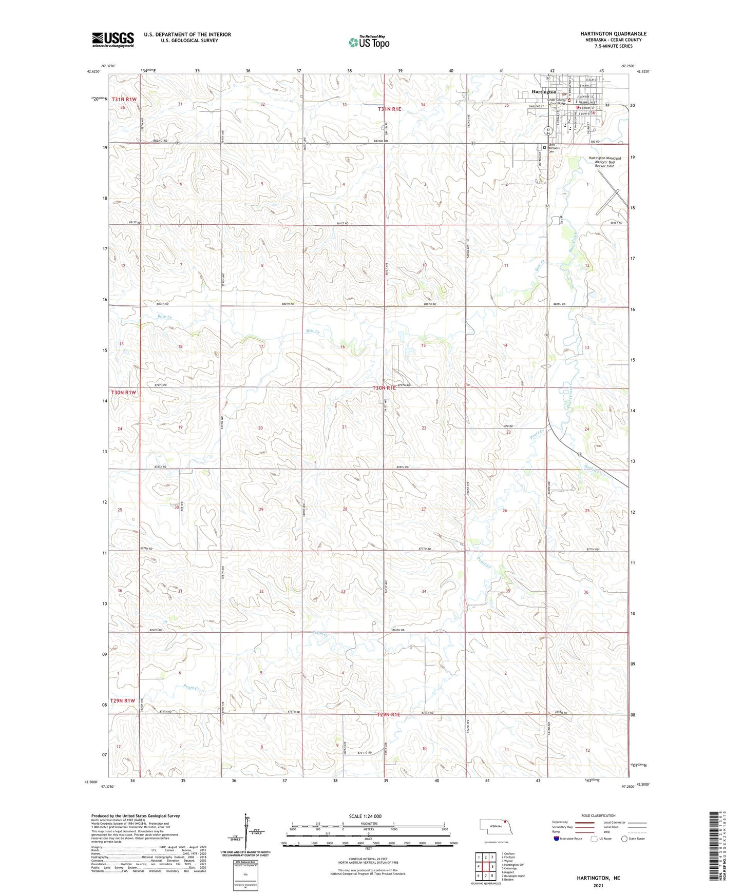
2021 topographic map quadrangle Hartington in the state of Nebraska. Scale: 1:24000. Based on the newly updated USGS 7.5' US Topo map series, this map is in the following counties: Cedar. The map contains contour data, water features, and other items you are used to seeing on USGS maps, but also has updated roads and other features. This is the next generation of topographic maps. Printed on high-quality waterproof paper with UV fade-resistant inks.
Quads adjacent to this one:
West: Hartington SW
Northwest: Crofton
North: Fordyce
Northeast: Wynot
East: Coleridge
Southeast: Belden
South: Randolph North
Southwest: Magnet
This map covers the same area as the classic USGS quad with code o42097e3.
Contains the following named places: C D Feedlots, Camper Court, Cedar Catholic High School, Cedar County, Cedar County Courthouse, Cedar County Historical Marker, Cedar County Historical Museum, Cedar County Sheriff's Office, City of Hartington, Election Precinct 12, Felber Park, Filips Eye Clinic, First Congregational Church, Hartington, Hartington Home of Two Nebraska Governors Historical Marker, Hartington Ambulance Squad, Hartington Elevator, Hartington Family Dentistry, Hartington Municipal Airport/ Bud Becker Field, Hartington Nursing Center, Hartington Police Department, Hartington Post Office, Hartington Public Library, Hartington Public Schools, Hartington Volunteer Fire Department, Holy Trinity Catholic Church, Holy Trinity Elementary School, Kerloo Creek, Pearl Creek, Precinct Seventeen, Precinct Twelve, Robins School, Sacred Heart Medical Center, Saint Michaels Cemetery, Trinity Lutheran Church, Washington