
MyTopo
Columbus SW Nebraska US Topo Map
Couldn't load pickup availability
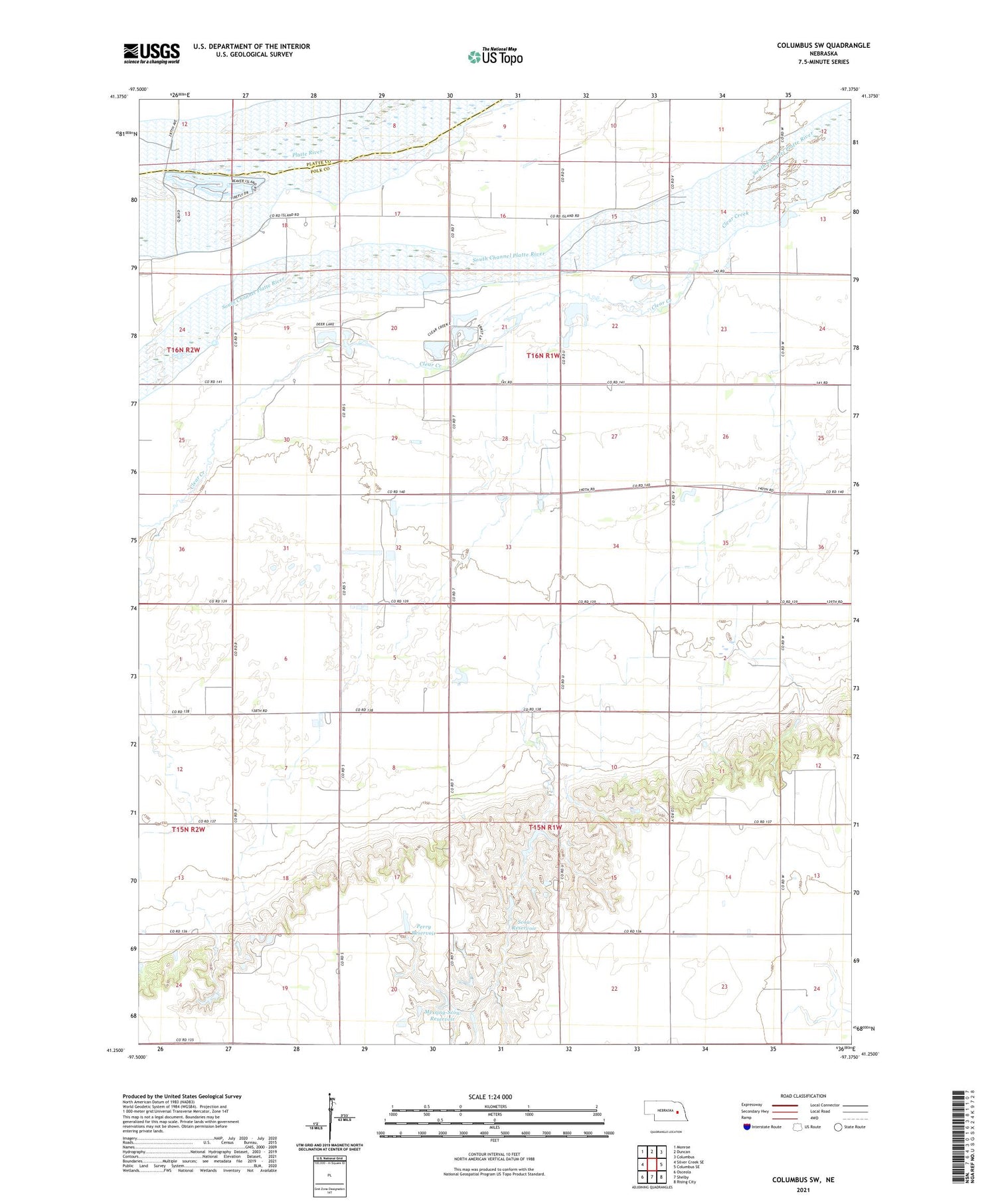
2021 topographic map quadrangle Columbus SW in the state of Nebraska. Scale: 1:24000. Based on the newly updated USGS 7.5' US Topo map series, this map is in the following counties: Polk, Platte. The map contains contour data, water features, and other items you are used to seeing on USGS maps, but also has updated roads and other features. This is the next generation of topographic maps. Printed on high-quality waterproof paper with UV fade-resistant inks.
Quads adjacent to this one:
West: Silver Creek SE
Northwest: Monroe
North: Duncan
Northeast: Columbus
East: Columbus SE
Southeast: Rising City
South: Shelby
Southwest: Osceola
Contains the following named places: Clear Creek-Island Election Precinct, KLIR-FM (Columbus), Messing-Scow Dam, Messing-Scow Reservoir, Perry Dam, Perry Reservoir, Saint Andrews Church, School Number 4, School Number 9, Scow Detention Dam, Scow Reservoir, Township of Clear Creek, Township of Island


