MyTopo
Monroe Nebraska US Topo Map
Couldn't load pickup availability
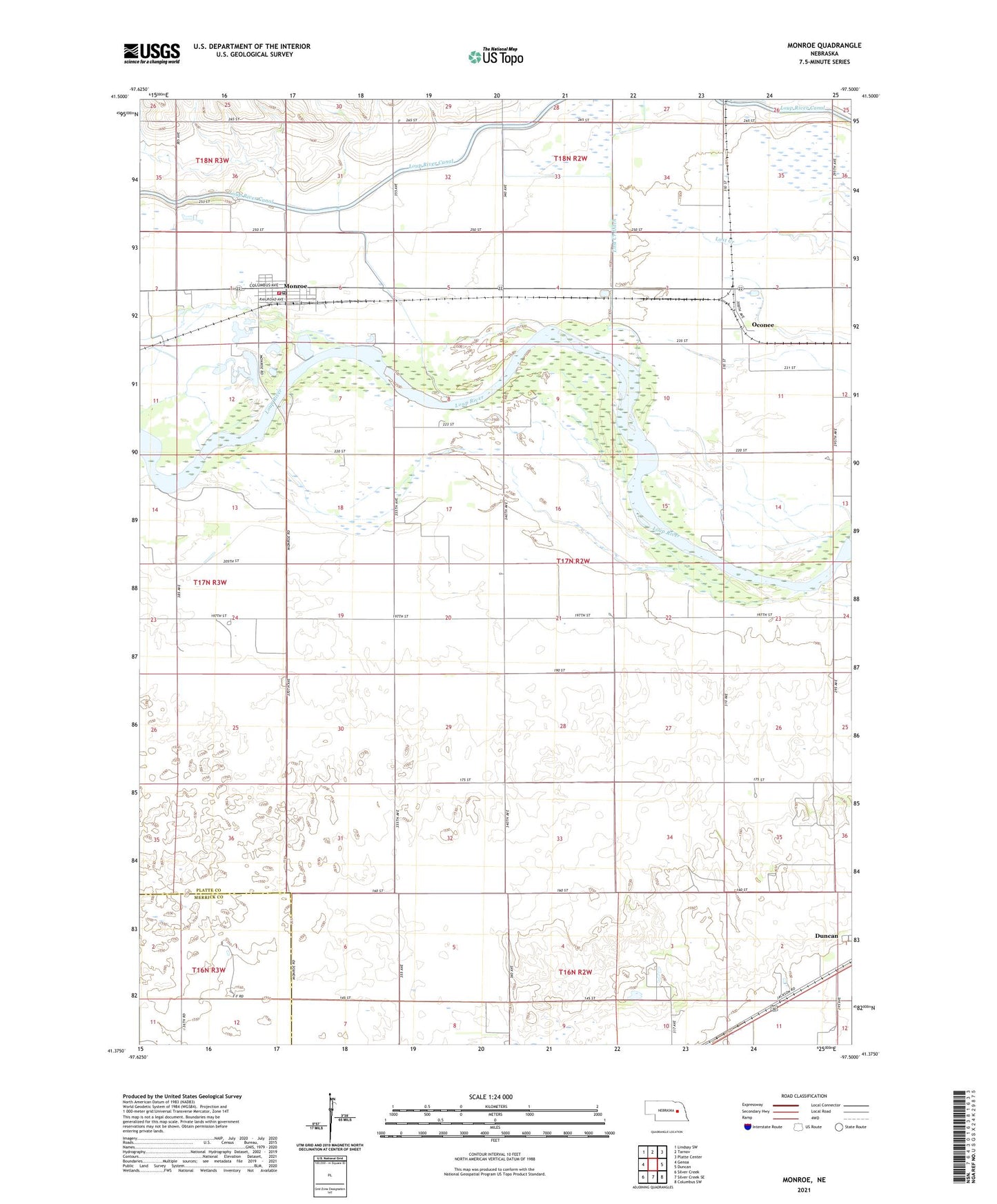
2021 topographic map quadrangle Monroe in the state of Nebraska. Scale: 1:24000. Based on the newly updated USGS 7.5' US Topo map series, this map is in the following counties: Platte, Merrick. The map contains contour data, water features, and other items you are used to seeing on USGS maps, but also has updated roads and other features. This is the next generation of topographic maps. Printed on high-quality waterproof paper with UV fade-resistant inks.
Quads adjacent to this one:
West: Genoa
Northwest: Lindsay SW
North: Tarnov
Northeast: Platte Center
East: Duncan
Southeast: Columbus SW
South: Silver Creek SE
Southwest: Silver Creek
This map covers the same area as the classic USGS quad with code o41097d5.
Contains the following named places: Gruetli, Gruetli Church, Lookingglass Creek State Wildlife Management Area, Lost Creek Ditch, Monroe, Monroe Methodist Church, Monroe Post Office, Monroe Public Schools, Monroe Rescue Unit, Monroe Volunteer Fire and Rescue Department, Oconee, Oconee Post Office, School Number 25, School Number 37, School Number 73, Township of Butler, Township of Loup, Township of Oconee, Tri Valley Co-op Elevator, Village of Monroe