MyTopo
Shelby Nebraska US Topo Map
Couldn't load pickup availability
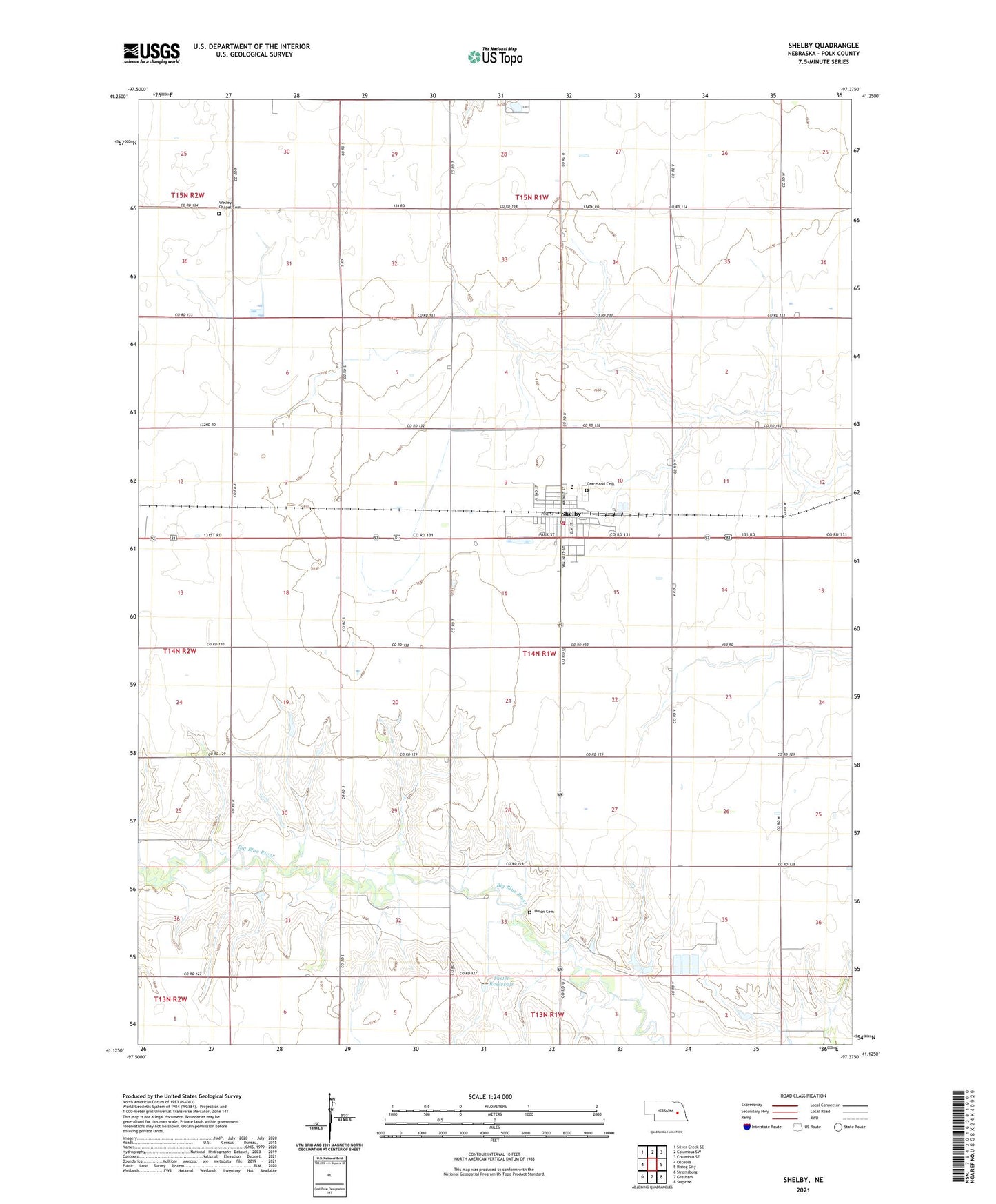
2021 topographic map quadrangle Shelby in the state of Nebraska. Scale: 1:24000. Based on the newly updated USGS 7.5' US Topo map series, this map is in the following counties: Polk. The map contains contour data, water features, and other items you are used to seeing on USGS maps, but also has updated roads and other features. This is the next generation of topographic maps. Printed on high-quality waterproof paper with UV fade-resistant inks.
Quads adjacent to this one:
West: Osceola
Northwest: Silver Creek SE
North: Columbus SW
Northeast: Columbus SE
East: Rising City
Southeast: Surprise
South: Gresham
Southwest: Stromsburg
This map covers the same area as the classic USGS quad with code o41097b4.
Contains the following named places: Farmers Co-op Business Association Elevator, Golden West Feedyards, Graceland Cemetery, North Canada Election Precinct, Sacred Heart Catholic Church, Sacred Heart School, Shelby, Shelby Clinic, Shelby Dental Care Center, Shelby Post Office, Shelby Public Library, Shelby Public Schools, Shelby Volunteer Fire and Rescue, South Canada Election Precinct, Thelen Dam, Thelen Reservoir, Township of Canada, Union Cemetery, United Methodist Church, Village of Shelby, Wesley Chapel Cemetery, ZIP Code: 68662