MyTopo
Osceola Nebraska US Topo Map
Couldn't load pickup availability
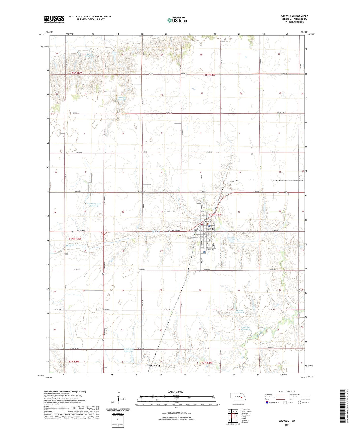
2021 topographic map quadrangle Osceola in the state of Nebraska. Scale: 1:24000. Based on the newly updated USGS 7.5' US Topo map series, this map is in the following counties: Polk. The map contains contour data, water features, and other items you are used to seeing on USGS maps, but also has updated roads and other features. This is the next generation of topographic maps. Printed on high-quality waterproof paper with UV fade-resistant inks.
Quads adjacent to this one:
West: Swedehome
Northwest: Silver Creek
North: Silver Creek SE
Northeast: Columbus SW
East: Shelby
Southeast: Gresham
South: Stromsburg
Southwest: Durant
This map covers the same area as the classic USGS quad with code o41097b5.
Contains the following named places: Anderson Dam, Anderson Reservoir, Annie Jeffrey Family Medicine, Annie Jeffrey Memorial County Health Center Hospital, Burritt Dam, Burritt Reservoir, City of Osceola, Davis Creek, Husker Co-op Elevator, Mentink Dam, Mentink Reservoir, Norman Leach Dam, Norman Leach Reservoir, Osceola, Osceola and the Early Pioneer: 1867-1967 Historical Marker, Osceola Drive Inn, Osceola Elementary School, Osceola Good Samaritan Center, Osceola High School, Osceola Lutheran Church, Osceola Post Office, Osceola Public Library, Osceola Volunteer Fire and Rescue, Pioneer Mental Health Center, Pleasant View Retirement Village, Polk County, Polk County Courthouse, Polk County Fair Grounds, Polk County Sheriff's Office, Ransom Dam, Ransom Reservoir, Rosenquist Dam, Rosenquist Reservoir, Ryan Hill Country Club, Saint Vincent Ferrer Catholic Church, South Osceola Election Precinct, Stromsburg Municipal Airport, Township of Osceola, United Methodist Church, ZIP Code: 68651