MyTopo
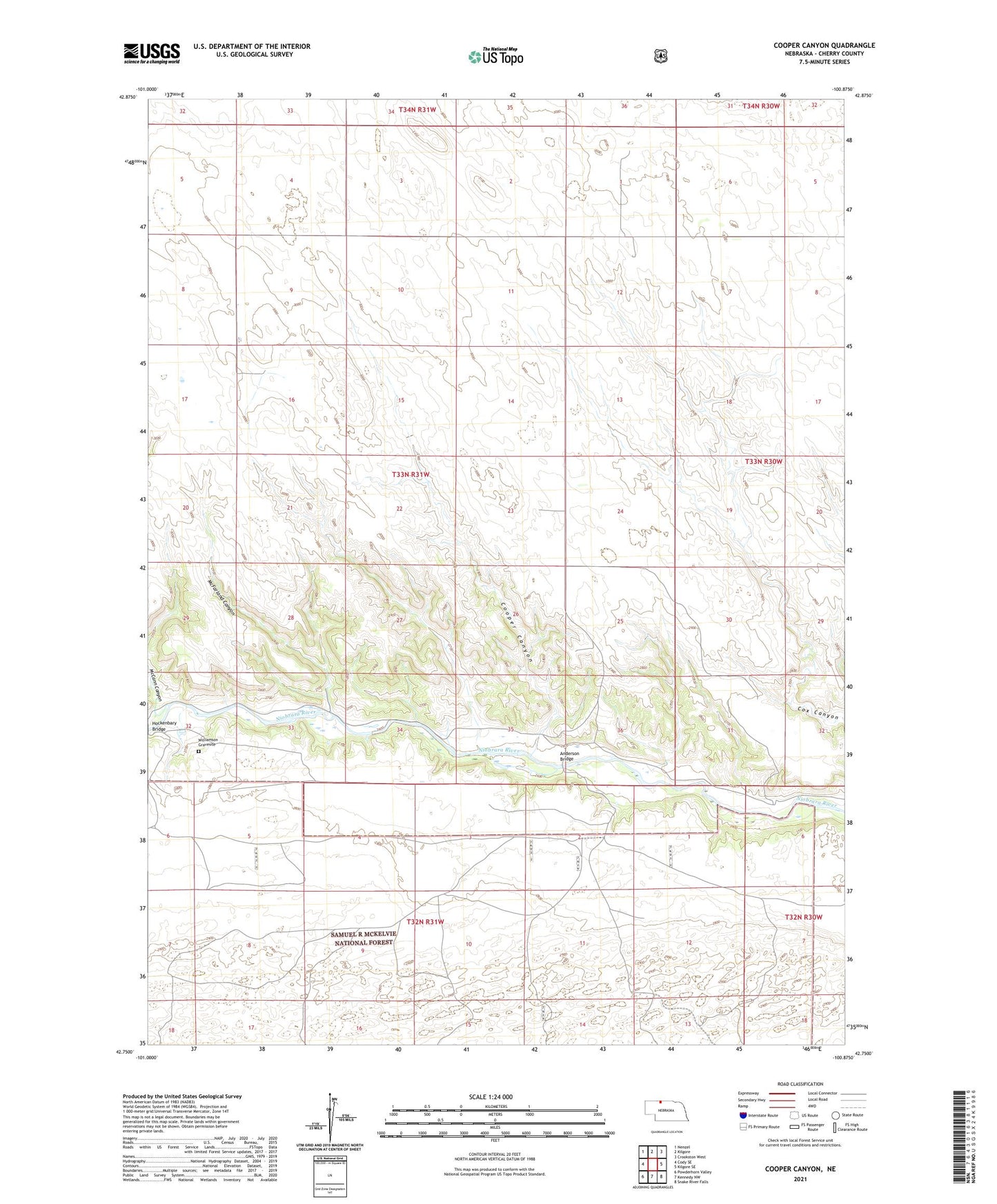
Cooper Canyon Nebraska US Topo Map
Couldn't load pickup availability
Also explore the Cooper Canyon Forest Service Topo of this same quad for updated USFS data
2021 topographic map quadrangle Cooper Canyon in the state of Nebraska. Scale: 1:24000. Based on the newly updated USGS 7.5' US Topo map series, this map is in the following counties: Cherry. The map contains contour data, water features, and other items you are used to seeing on USGS maps, but also has updated roads and other features. This is the next generation of topographic maps. Printed on high-quality waterproof paper with UV fade-resistant inks.
Quads adjacent to this one:
West: Cody SE
Northwest: Nenzel
North: Kilgore
Northeast: Crookston West
East: Kilgore SE
Southeast: Snake River Falls
South: Kennedy NW
Southwest: Powderhorn Valley
This map covers the same area as the classic USGS quad with code o42100g8.
Contains the following named places: Anderson Bridge, Anderson Bridge State Wildlife Management Area, Cooper Canyon, G Drinkwater Ranch, Galloway Ranch, Goodwin Dam, Goodwin Reservoir, Grover Hill Ranch, Hockenbary Bridge, McCann Canyon, McFarland Canyon, Monnier Ranch, P Goodwin Ranch, Ridge Ranch, School Number 182, School Number 73, School Number 87, Stolzenburg Ranch, T Trappel Ranch, Van Winkle Ranch