MyTopo
Cornell Dam Nebraska US Topo Map
Couldn't load pickup availability
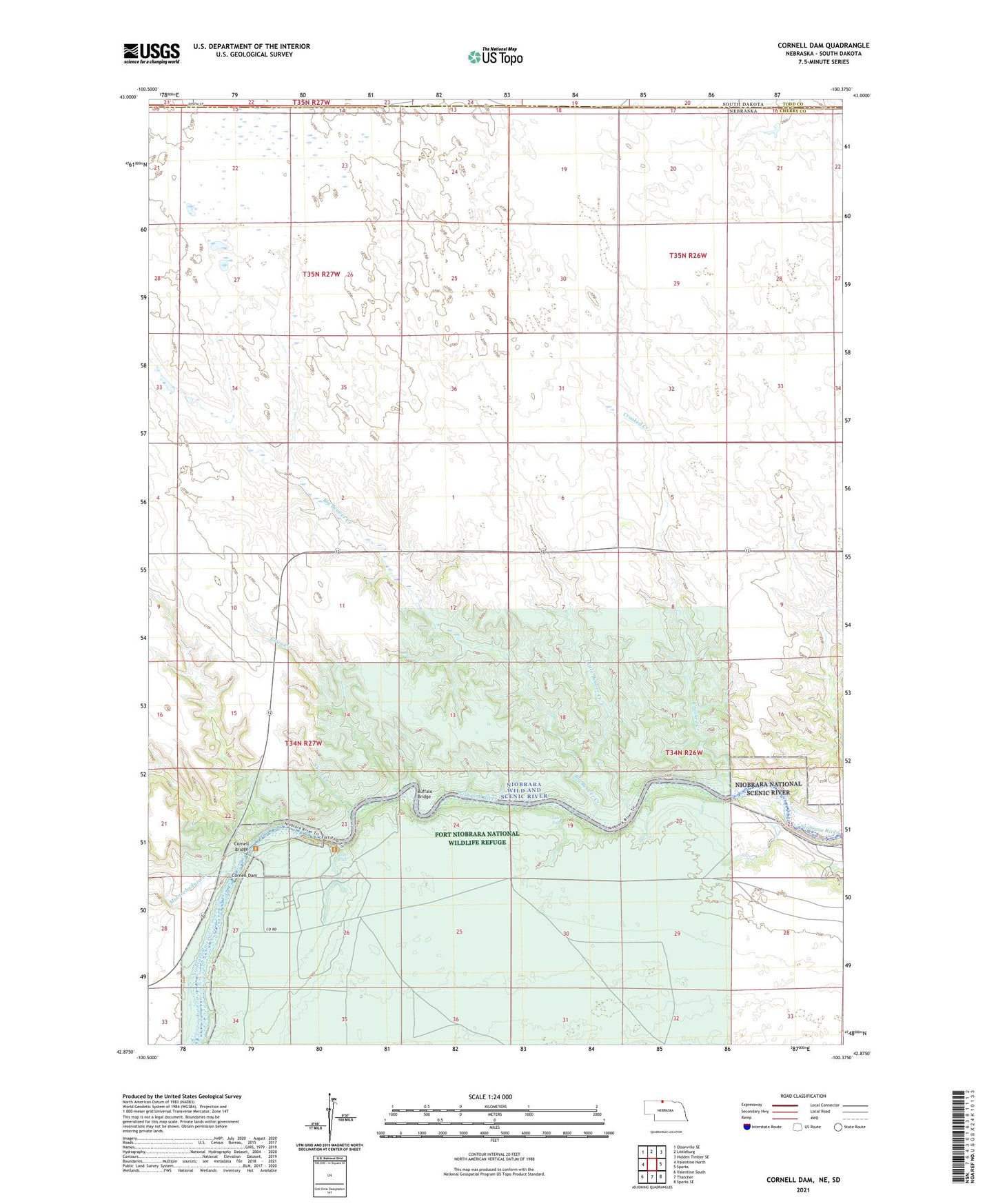
2021 topographic map quadrangle Cornell Dam in the state of Nebraska. Scale: 1:24000. Based on the newly updated USGS 7.5' US Topo map series, this map is in the following counties: Cherry, Todd. The map contains contour data, water features, and other items you are used to seeing on USGS maps, but also has updated roads and other features. This is the next generation of topographic maps. Printed on high-quality waterproof paper with UV fade-resistant inks.
Quads adjacent to this one:
West: Valentine North
Northwest: Olsonville SE
North: Littleburg
Northeast: Hidden Timber SE
East: Sparks
Southeast: Sparks SE
South: Thatcher
Southwest: Valentine South
Contains the following named places: Big Beaver Creek, Bryant Ranch, Buffalo Bridge, Coon Creek, Cornell Bridge, Cornell Dam, Cornell Dam School, Crooked Creek, Deer Park Country Club, Fort Falls, Fort Niobrara National Wildlife Refuge, Fort Niobrara Wilderness, Little Beaver Creek, Minnechaduza Creek, School Number 33, Short Creek, Tyler Falls