MyTopo
Valentine North Nebraska US Topo Map
Couldn't load pickup availability
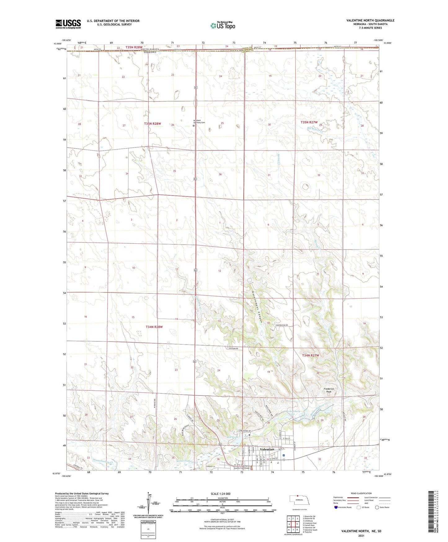
2021 topographic map quadrangle Valentine North in the state of Nebraska. Scale: 1:24000. Based on the newly updated USGS 7.5' US Topo map series, this map is in the following counties: Cherry, Todd. The map contains contour data, water features, and other items you are used to seeing on USGS maps, but also has updated roads and other features. This is the next generation of topographic maps. Printed on high-quality waterproof paper with UV fade-resistant inks.
Quads adjacent to this one:
West: Crookston East
Northwest: Olsonville SW
North: Olsonville SE
Northeast: Littleburg
East: Cornell Dam
Southeast: Thatcher
South: Valentine South
Southwest: Valentine SW
Contains the following named places: Assembly of God Church, Berean Fundamental Church, Cherry County Court House, Cherry County Hospital, Cherry County Physicians Clinic, Cherry County Sheriff's Office, City of Valentine, Decker School, Ecological Park, Fish Hatchery Lake, Fishberry Creek, Frederick Peak, Government Canyon, McCormick Eye Clinic, Mid - Cherry Rural Fire District, Mill Pond, New Harmony School, Pierce Milling Plant Dam, Pierce Milling Plant Reservoir, Pine View Clinic, Pine View Good Samaritan Center, Presbyterian Church, Richland Harmony Cemetery, Saint Johns Episcopal Church, Saint Nicholas Church, Sandhills Museum, School Number 12, School Number 121, Seventh Day Adventist Church, Spring Creek, The Church of Jesus Christ of Latter Day Saints, United Methodist Church, Valentine City Park, Valentine City Park Campground, Valentine City Park Dam, Valentine Elementary School, Valentine Mill Pond Dam, Valentine Police Department, Valentine Public Library, Valentine Rural High School, Valentine State Fish Hatchery, Valentine Vision Center, Ward School